3-31 12z runs are in Euro - colder. East over BM. Only .3 in precip, mostly at below 0 850 temps, but not dynamic enough to support accumulation. GFS - now near BM, .barely 5 precip, mostly at below 850 temp - see euro CMC is hanging in there, per below UKMET - complete miss, OTS Except for the CMC, the models don't deepen this until its past cape cod. With all the components on the playing field and sampled, its hard to argue. 3-6 inches may not hold for DXR anymore.
 12z RGEM over BM
 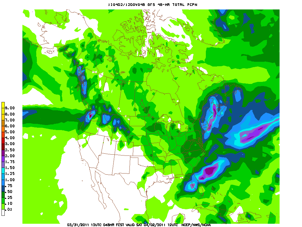 12 gfs precip - shifted east 3-31 Track is still wobbling Things are usually clearer at 12hrs out, but the GFS moved west overnite, causing mostly rain for places within 60 miles of NYC, mix on the fringes, as did the NAM. Euro did not make that adjustment, and neither did the ukmet or cmc. Then the 6z runs of the NAM and GFS were a little east, and then the 12z runs were further east. So the track looks more favorable for some snow, but instead of the storm deepening south of LI, its now not progged to deepen on these to models until its past CCOD. So even though the temps aloft are cooler, there is much less precip - only .5 in DXR and less further west. So less precip means of course less rain or snow. But without the dynamics of the deepening and heavier precip, the ability to draw cold air from the atmosphere means its more difficult to change to snow. Per the 12z NAM and GFS, areas west of NYC may not get much at all. 12z RGEM is out with the low going over the BM, and is more bullish on the precip, but still its far enough east to have NEPA miss heavy precip. Experience shows thought that the precip shield on the models more often spreads further north and west than indicated, so the RGEM looks ok compared to GFS. I'm still with 3-6 for SW CT, 6+ for NW CT. However for NJ, I'm decreasing to 2-4, with 6" only at 1000 feet or higher. Will update when 12z foreign runs are in.
  euro 12z
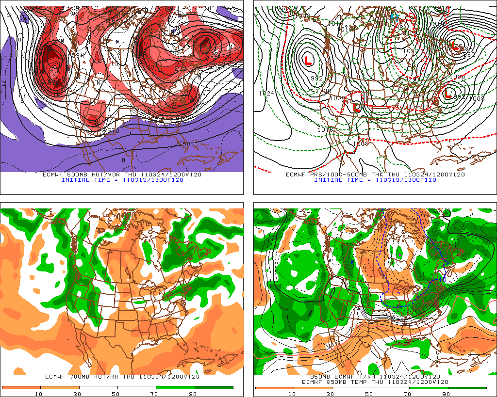
  ukmet 12z 3-30 Its the track.... 12z runs pushed a bit east, with Euro moving most of W nj, hud val, and ct back into the snow, or at least wet snow range. GFS nudged east, NAM catching on finally, but still east. GFENS are not supporting the GFS with their 850 temps being south of NYC for most of the event, and surface low closer to the BM than Islip. UKMET also shifted east to a snowier solution. No reason to change forecast based on 12z runs. Euro has snow though for Thurs, which I'm doubting will amount to anything. Below is the output for the euro - note surface temps above freezing, 850 is below, but not enough for pure snow, although the critical thickness of 540 is met. day-time--sfc---850---slp---prec--- hgt --- thck
 THU 18Z 5.8 -2.9 1011 0.01 547 539------------------------------------------------------------------------------- This mornings runs all lean toward a massive rain event for the tristate, with snow pushed into NEPA, Catskills and Mass. This is due to the track of the 500 low, 850 low and surface low. Most models place the surface low between NYC and the BM. This brings in warmer air from the ocean to places which would have avoided it if it were closer to the BM. Example - DXR now would have an E or SE wind, instead of a N or NE wind. With the 850 low going over NYC, the areas east will have temps above 0c. There would be some mixing inland, with maybe some minor accum on the front and back end. Now, the NAM is still not looking right, and the ensembles have a perfect placement for a major snowstorm for the N and W subs of NYC. I'll still stick with a 3-6 inch storm here and in the NW subs, with over a foot in higher elevs as mentioned above. If storm moves further east, will have to go all rain.
FRI 00Z 3.3 -1.0 1009 0.05 546 539
FRI 06Z 2.2 -0.1 1003 0.18 543 540
FRI 12Z 1.2 -1.6 995 0.55 536 540
FRI 18Z 1.5 -4.6 991 0.36 529 536
SAT 00Z 1.5 -5.4 994 0.17 527 532
 CMC above
  Gfs precip
  Euro precip
  GFS mslp and 850 line 3-29 Big developments 0z gfs brings stacked low, 980 at surface over NNJ at 18z Friday - rain to snow, mostly rain for tristate 12z moves off coast with 980 over ACK at 18z, stacked, with mostly snow for tristate (mix on the coast), precip 1.25, see pic 0z euro haz 984 low over BM at 18z fri, all snow and precip near 1" 12z euro haz 980 low, closer to Block Island, all snow and precip near 1.5" - winds 30-40, see precip graphic 0z RGEM has 979 low passing just se of BM at 21z, barely glancing us with showers 12z RGEM has 969 low passing over BM, just off CCOD, mostly snow for us. 0z Ukmet brings 984 low se of BM 12z ukmet brings 984 low up into LI by 12z Friday - real close for thickness and 850 line JMA is on board with 990 low parked over Texas Tower, though not closed off. Euro ens support the operational, which is odd. Gfs ens are se of the operational, which is usual. Spread is greatest to the NW. The 850 temps are really cold though. Precip of .5 in the area SREF ens look to take the low just SE of the BM, with the spread to the SW, which indicates the WRF members which I will explain next. Precip of .5 WRF/NAM has the first storm blowing up off the coast, and then just a mess of LP, disorganized coming afterwards. In short, no storm on the NAM at all. This is where some of the other models were a few days ago, but each NAM run is consistent. Even so, the first storm drops .5 in the form of snow, but on Wed nite into thurs. Call - 72 hrs out with a lot of consensus as to something big coming. Its going to be tough in the city and along the coast, but just inland, 3-6 seems assured with a chance for up to a foot. NWS Upton caught on in the afternoon shift, and now lowered temps into the mid 30's with 70% chance of snow. Elevation will matter - could be over a foot in areas over 1000 feet. This event is different than last week. Last week was a weak storm, throwing bursts of snow which could not amount to much. If this stays forecast around 980mb, stacked, it will be strong enough to pull down cold air from aloft, and accumulate. Whats missing is a strong high to the north (instead is a weaker high sliding off, which will still keep in some cold air, but not enough), and the exact track. 18z gfs run just came in and it brings the low closer in, resulting in more rain for the city and coast. Mix inland. We'll see what the nam brings in at 0z- if it catches on or not. NCEP has a 10% chance of over a foot.


.gif)
