11/8 - morning
Not much additional snow accumulated despite constant snowfall overnight. Damage was minimal, a limb next to the driveway and bent over or snapped bushes. Power remained on overnight as the winds knocked the snow from the trees and wires, but were not enough to blow over trees.
11/7 evening
Started snowing around 11 or so in the morning, came down hard for a few hours and piled up a few inches fast. Snowed moderately the rest of the day with 8 inches on the grass here, 9.9 officially from the NWS for Danbury. Winds never amounted to anything, but they did get gusty later in the day. Anenometer froze around 2pm so didn't get any readings here.
11/6
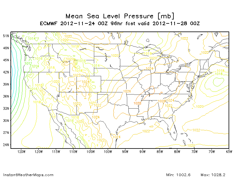
Afternoon - Models shift back west - but the precip doesn't amount to much here. Southern NJ is jackpot. Temps aloft and at the surface now to be below freezing most of the event, per 18z runs. Main concern continues to be winds, at the coast over 40mph gusts to 60. Inland gusts to 50. Coastal flooding still an issue, with moderate flooding expected. Strength of the storm varies, with some models coming in below 980 while others are 990 or higher. But all models have snow or rain/snow mixes in their latest runs. Below are some of the snow maps.
12zgfs
12z nam
18z gfs
18z nam
Euro Snow
I think it will snow! I hope its just an inch or two. I'm worried about the precip being underdone by the Euro and GFS and overdone by the NAM (which is typical). Snow for CT is showing up in the form of a band, like you would find in a tropical storm, and as that band comes through, it could snow hard, and that may be it.
Morning - 24-48 hrs away from the event. Everything up in the air.
18z gfs went way east, 0z came back a bit west (so much for these that the winds weren't bad and there was a few inches of snow in S NJ and E CT. 6z is back right off the coast with snow in Philly. Euro held tight until it moved a bit east for 12z and further east for 0z. Both models have lows around 989 now. 0z cmc is way, way off the coast keeps pressure in 990's. NAM deepens to sub 980 on its last three runs but has 100 miles between the runs, going back and forth. 18z and 0z runs had a couple inches of snow for S NJ, NYC and CT, but the 6z run has nothing. UKMET is only model consistently out to sea with no precip.
Winds - GFS still has 60mph gusts for most of the area. Latest NAM only has >50mph gusts for RI, Montauk, Cape Cod. Euro gusts are <40kts 50="50" and="and" are="are" ct.="ct." ct="ct" e="e" for="for" greater="greater" gusts="gusts" kts="kts" li="li" nbsp="nbsp" nj="nj" nyc="nyc" p="p" ri="ri" some="some" there="there" w="w">
This mornings call - some rain/snow for a lot of the area, should be less than an inch of both, winds 15-20 mph inland with gusts to 30. Coastal winds 20-30 with gusts of 40-50. Coastal flooding less concerning than yesterday, water should still exceed the astronomical maximum, which usually means flooding.
11/5
Morning - tree clean up on the street.
CMC is the lowest at 967 - takes up coast, just offshore, keeps entire area below 0 at 850. Stalls south of LI, then moves over martha's vineyard. 6z nam bottoms out at 975 but well east of the BM - little precip for anyone. Then the 12z brings the 975 low up into RI/MA border resulting in 50mph gusts over CT (not west of there though), and the snow map below.
Then there is the GFS - 6z run is crazy with snow for NW CT and Catskills. Bottoms out 987mb, but keeps the low south of LI for a while.
Euro is steady, showing snow 1-3 inches for much of CT and NW NJ with 6-9 in the Catskills. Bottoms out at 983 off NJ with a move due east when south of LI. Winds are tough, 40+kts on the shore, but inland not too bad. Gusts are 40-50kts at max inland, 60kts+ along the coast and LI.
Surge predictions are 3-4 feet along the NJ coast and up to 5-7 feet in the Sound. Wave chart below moslty 9-12 feet along NJ, higher in LI and north shore of Mass.
11/4
Evening -can still hear generators running
NAM has storm tracking well east of NJ with minimal affect to points west of New Haven. What is most shocking is that it goes to 965mb. This is only rivaled by the CMC which takes it just southeast of the BM with 968 pressure. Euro remains a coast hugger, but only as low as 980. 18z GFS takes it about 50 miles east of the euro, but still close to shore, and down to 978.Both models have gusts maxing out at 70mph. JMA is rather east, but hits benchmark still with 981 pressure. UKMET is similar to GFS with 980 low inside the BM. GFS has full support from its ensembles, Euro ens are a bit east of it, which is normal. GGEM ensembles are way east of it. So there is still some hope this thing goes further out to sea than expected.
Morning
CMC starts a 987 low off OBX, wed 7am, brings to a 969 low well off the coast, but close enough for precip and wind by wed 7pm, by thurs 7am its 966 low east of Pt Pleasant and south of RI, by thurs evening its 975 just to the north, northeast of the benchmark. 850 temps below 0 the entire time for most places west of CT river and nassau county. Ground temps are in the mid 30's. Precip for DXR is about an inch. Track has north winds mostly along the coast except in the beginning.
UKMET has a 982 low off the MD coast on wed evening, brings to west of boston by thurs evening. Can't tell precip just yet or 850 temps.
JMA hits benchmark, but moves fast.
0z Euro forms 1004 low off Savannah on Tues evening. By wed morning, its 996 low off NC/SC. By wed evening, its 984 low 100 miles off VA/NC border. Thurs morning its only up to DE and down to 980 pressure. Thurs evening its 984 at 40/72, well inside the benchmark. Fri morning its 992 near ACK and headed east. Winds - 850 winds turn east Tues nite. By wed afternoon, they are over 75 kts from NJ to VA. Wed evening they are over 75 kts from NH to VA. These may mix as gusts in heavier precip or in warm sector. 65+kt 850 winds last 36 hrs in the NYC area. Surface winds: by wed afternoon, +65kt winds are off shore blowing east and coastal sections are getting 30-50kt winds sustained. Those winds do not get far inland, but gusts of 40-50mph can. Snow - 850 temps are very close to supporting snow at the beginning of the event. Amounts of 1-3 inches in N-NW NJ and western CT are possible, while Central PA gets 6-10.
GFS - 0z brings 994 low 100 miles east of NC to 980, up 70 W over the benchmark and then over ACK. 6z run is 50 miles or so west of the 0 run. 850 temps adjust the same. GFS is faster than Euro as well. Winds are comparable to Euro gusts and sustained. Nothing like Sandy, but strong gusts anyway.
Snow - both 0 and 6z runs have an inch over most of nj. Bergen county gets 4 in both runs as well, DXR gets 4-8 between the two runs. The main difference is that the most snow on the 0z falls in the berkshires, the 6z is the catskills. 6z has more snow for the middle of nj, all the way down to Jackson. Snow could cause major issues in NJ and Southern CT.
Waves -look to be 12-15 ft at the height.
11/3 - Internet service restored! Classic noreaster forecast to hit now...
Morning runs of Euro and UKMET have 986ish low tucked into the coastline. Hurricane strength winds over water and into LI at times. Low stalls as well only moving from SNJ to LI in 24 hrs. This is probably worst cast scenario.
0z gfs was off the coast, giving us snow actually. Weaker 996 low. This is best case scenario, except for the fact that there are still leaves on trees and snow is going to be wet and heavy. But it does spare the NJ coast the worst of the winds and keeps them in the N direction.
6z run puts a 980 low over benchmark. This covers all of NJ with snow - probably the worst case scenario as most trees still have leaves.

12z gfs brings 982 low right up the slot, into Montauk, and Rhode Island. This is bad for the coast, but should spare most of the immediately affected areas from heavy wet snow. However gfs snow map shows even more snow, and this is now the worst case scenario. Most of the coast sees 40-50kt winds, but out of the north to north east. This should limit coastal flooding a bit.


.gif)
