
Evening - turned over full time at 3pm. Three small trees down on property, only a coating of snow
Heres the storm before dark

Noon update - changed back to rain and warmed for a while from 11am to 12:30. Changing back now.
Officially a blizzard as of 1pm


3-2 One of those crazy storms where the rain goes east to west. Woke up at 7am, school is closed. Wind howled most of the night, but off and on. Rain poured. 1" so far today. The GFS had a morning temp of 43 as of the 12z run yesterday, while Euro and NAM were closer to 35/36. Its 35.6 now at 12z. Sleet has mixed in much earlier than thought.


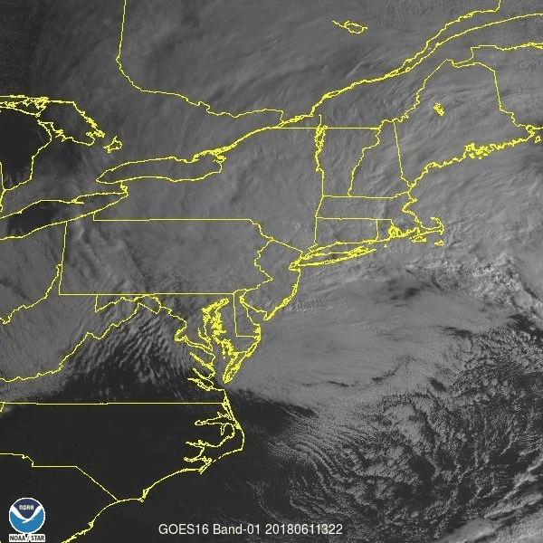
3-1 Crazy thing is it looks like its going to miss us on the satelite.

2-28 - File in why snow maps dont work. We are 48-72 hours out on these runs from the NAM.

GFS still refuses to bring more than a coating of snow to our area. But it may be coming around.

The Euro on the other hand had this map to offer.


2-27 pm. NAM just is off its rocker.

Gray areas are 36-40". The snow is wet too.

2-27 Storm is still fascinating. CMC, GFS and NAM handling differently 3 days out. NAM is much colder at the surface. Still unsure if there is snow with this due to higher surface temps to start, but wouldn't be surprised if we got a spring storm, wet fat flakes, out of this that put an inch or two on the ground. Then melts. I think its more than likely areas over 1000 feet, especially NW NJ, NEPA, Catskills, MHV, Litchfield and areas in N Fairfield county could see 2-4 if not more, while valleys only get their grass covered. Its going to depend on where dynamics set up. Here are some of the loopy loops.


I don't have the Euro loop today though - its off shore, doesn't bring much as it blows through here and stalls offshore. However the Euro has gone from this at 12z
ECMWF Deterministic FORECAST FOR:  LAT =  41.38  LON =  -73.46

                                            12Z FEB26
                 2 M     850     SFC     SFC     700    6 HR     500    1000
                 TMP     TMP     PRS     RHU     RHU     QPF     HGT     500
                 (C)     (C)    (MB)    (PCT)   (PCT)   (IN)    (DM)     THK
THU 12Z 01-MAR   4.7     3.0    1010      94      88    0.02     552     543
THU 18Z 01-MAR  12.0     1.8    1008      61      15    0.00     552     546
FRI 00Z 02-MAR   8.1     1.9    1007      87      50    0.01     550     545
FRI 06Z 02-MAR   3.7     0.6    1004      97      92    0.07     545     542
FRI 12Z 02-MAR   2.3    -0.3    1002      95      98    0.21     541     539
FRI 18Z 02-MAR   4.3     0.8    1006      90      67    0.14     543     538
SAT 00Z 03-MAR   3.6    -0.8    1013      71      42    0.00     547     537
to this at 0z - which is a mixed bag for results. Lower 850 temps, but warmer surface pre storm.
ECMWF Deterministic FORECAST FOR:  LAT =  41.38  LON =  -73.46

                                            00Z FEB27
                 2 M     850     SFC     SFC     700    6 HR     500    1000
                 TMP     TMP     PRS     RHU     RHU     QPF     HGT     500
                 (C)     (C)    (MB)    (PCT)   (PCT)   (IN)    (DM)     THK
FRI 00Z 02-MAR   7.7     2.1    1007      83      72    0.00     549     543
FRI 06Z 02-MAR   5.0     0.2    1007      97      99    0.07     545     539
FRI 12Z 02-MAR   4.0    -0.8    1004      98     100    0.08     542     538
FRI 18Z 02-MAR   4.5    -0.4    1005      98     100    0.31     541     537
SAT 00Z 03-MAR   3.7    -2.2    1012      92      93    0.25     544     534
SAT 06Z 03-MAR   1.4    -2.5    1016      89      68    0.00     546     533
compared to NAM
NAM/WRF 40Km FORECAST FOR: DXR    LAT=  41.37 LON=  -73.48 ELE=   456

                                             1A FEB27
                 2 M     850     SFC     SFC     700    6 HR     500    1000
                 TMP     TMP     PRS     RHU     RHU     QPF     HGT     500
                 (C)     (C)    (MB)    (PCT)   (PCT)   (IN)    (DM)     THK
TUE  1A 27-FEB   0.7    -3.7    1026      65       7             553     533
TUE  7A 27-FEB   0.8    -4.8    1028      65      16    0.00     552     530
TUE  1P 27-FEB   9.6    -3.4    1027      41      19    0.00     555     533
TUE  7P 27-FEB   7.5    -2.3    1025      60      35    0.00     557     537
WED  1A 28-FEB   5.6    -0.2    1023      65      27    0.00     556     537
WED  7A 28-FEB   3.9    -0.1    1020      63      22    0.00     554     538
WED  1P 28-FEB  10.7     1.0    1016      53      51    0.00     555     542
WED  7P 28-FEB   8.7     3.0    1014      76      79    0.00     554     543
THU  1A 01-MAR   7.6     2.9    1012      83      74    0.00     553     543
THU  7A 01-MAR   5.9     2.1    1012      94      82    0.00     553     543
THU  1P 01-MAR  11.4     2.1    1009      69      81    0.00     553     545
THU  7P 01-MAR   5.2     0.2    1004      93      97    0.08     549     546
FRI  1A 02-MAR   3.5     1.1     993      93      98    0.48     541     546
FRI  7A 02-MAR   0.9    -0.4     989      96      97    0.98     535     544
FRI  1P 02-MAR   1.1    -3.4     994      92      97    0.48     535     540
|
Here you can see its below freezing through 950mb which given the low pressure is probably around 1000-1500 feet.
NAM/WRF 40Km FORECAST FOR: DXR    LAT=  41.37 LON=  -73.48 ELE=   456 TMP


PRESSURE LEVELS  SFC  1000   950   900   850   800   750   700   650   600
TUE  1A 27-FEB   -1     2     2    -1    -4    -7   -10   -11   -12   -16
TUE  7A 27-FEB   -1     1     1    -2    -5    -7    -9   -11   -14   -18
TUE  1P 27-FEB   15     8     4     0    -3    -5    -7   -10   -14   -17
TUE  7P 27-FEB    2     8     6     2    -2    -4    -5    -8   -12   -16
WED  1A 28-FEB    0     6     6     2     0    -2    -5    -9   -12   -16
WED  7A 28-FEB    0     4     6     3     0    -3    -6    -8   -10   -15
WED  1P 28-FEB   16    10     6     4     1     0    -1    -5    -9   -15
WED  7P 28-FEB    6     9     7     6     3     1    -1    -6    -9   -14
THU  1A 01-MAR    4     8     9     6     3     0    -3    -6    -9   -12
THU  7A 01-MAR    4     8     8     5     2    -1    -3    -5    -9   -13
THU  1P 01-MAR   14    11     7     4     2    -1    -3    -4    -8   -12
THU  7P 01-MAR    5     6     3     3     0     0    -1    -3    -6   -10
FRI  1A 02-MAR    3     5     2     2     1     0     0    -2    -5    -9
FRI  7A 02-MAR    1     2     0    -2     0     0    -2    -4    -6    -9
FRI  1P 02-MAR    2     2    -1    -3    -3    -4    -6    -7    -8   -10
Then there is the GFS which pummels us with precip, cools the 850 but leaves the surface super warm.
GFS 0.5 Degree FORECAST FOR:  LAT =  41.38  LON =  -73.46

                                            06Z FEB27   * - APPROXIMATED
                 2 M     850     SFC     SFC     700    6 HR     500    1000
                 TMP     TMP     PRS     RHU     RHU     QPF     HGT     500
                 (C)     (C)    (MB)    (PCT)   (PCT)   (IN)    (DM)     THK
THU 06Z 01-MAR   7.1     2.4    1013      87      99    0.03     553     542
THU 12Z 01-MAR   5.4     3.7    1012      88      78    0.00     554     544
THU 18Z 01-MAR  12.5     2.6    1009      61      49    0.00     553     546
FRI 00Z 02-MAR   7.7     2.0    1006      86      99    0.05     550     546
FRI 06Z 02-MAR   6.0     2.0     999      91      99    0.42     544     544
FRI 12Z 02-MAR   5.8     0.8     994      90      99    0.29     536     541
FRI 18Z 02-MAR   4.8    -3.6     996      82      99    0.72     536     539
SAT 00Z 03-MAR   5.0    -2.7    1004      79      99    0.27     543     540
SAT 06Z 03-MAR   2.4    -1.5    1010      82      94    0.13     546     538
2-25 Storm still looks weird to me. Its weak at first, goes into OH, then reforms off the coast as an upper low comes down. Its captured by the upper low and stalls, with some runs bombing it out (CMC to 959,, euro and gfs to 978). Keep in mind when looking at these that every storm so far this year has been in and out. Quick hits. These loops are 4 days.
 |
| CMC |
 |
| Euro |
 |
| 18z GFS |
 |
| Euro with 50kt gusts for CT |
 |
| GFS with 55kt gusts |
Speaking of flooding, 4.5 inches of mostly rain is progged by the GFS.
 |
| 18z GFS |
 |
| 3.5" on Euro in MA |
For snow, these.


Still time for change - but for now I'm looking at a mostly rain, turning to snow event.
===========================================================
2-24 Still some interesting runs, but mostly rain. Euro has a neat 0z run for just to our west.


And the JMA backed off - keeps it south and out to sea

2-23 Once that ridge breaks down, the NAO is set to tank, which will result in blocking and some interesting model runs. Here's todays 12z gfs which has a low pressure for days off the NE. Yet yields not an inch of snow.


.gif)
