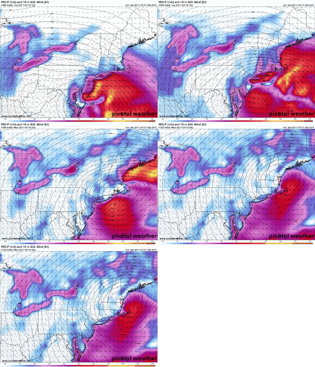
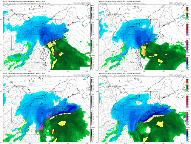
3-15 NAM had the storm further west than any model once at 84hrs. This was not unusual. The NAM continued to trend west though, as the GFS hung east until the last day. UKIE was first to go west, then CMC, then Euro, and the GFS even on the day of the storm took it to benchmark.
Here is a graphic of the result:
A lot of discussion occurred when the NWS didn't drop Blizzard warnings right away. They leaned heavily on the GFS, and when it was apparent it was shifting north, they kept the warnings up until the sleet set in. All in all, the forecast was off by about 25-30 miles, but affected millions of people.
Here was Uptons snow map from 6 hours before the snow began (10:30pm for here)
This was a compilation of snow maps from 5pm on the 13th. So it really came down to the I95 corridor missing out on double digit snow, but it did snow in most areas enough to warrant a Winter Storm Warning.
Lastly, I came in second for the Accuweather forecast challenge of 2017
3-12
Afternoon runs. CMC goes nuts.
Then the UKMET came with this monster
Morning runs. Euro goes nuts. Gusts near 100mph over the ocean
NAM cutoff isn't temp related, so it looks fishy.
CMC is madness
GFS is furthest east now, but not by so much that its a foot difference. I think its having precip field issues.
SREF has been consistent over the last 3 runs of between 10-12 inches.
So far, I like the idea of widepread 8-16 inches, with 10-14 for here.
+++++++++++++++++++++++++++++++++++++++++++++++++++++++++++++++++
3-11 Afternoon runs
NAVGEM
Options from the morning runs are:
 |
| CMC |
 |
| Euro |
 |
| GFS |
###########################################################################
3-10 GFS furthest west at this point. Track doesn't concern me too much, but the 87kt winds and 3+" of precip don't come from a low that bottoms out at 990mb. Something doesn't add up.
Now for some snow maps - CMC and GFS going in opposite directions. Euro a tad west.
 |
| 0z CMC |
 |
| 12z CMC |
 |
| 6z GFS |
 |
| 12z GFS |
 |
| 0z Euro |
 | |
| 12z euro |
3-9 GEFS members.
Euro version with 850 line.
Wider Euro version
CMC, Euro and GFS all on board with similar runs to what you see above. All bring significant snows up the east coast. Differences persist with the strength of the low, and I think qpf may be underdone. There is still room for it to come closer to the coast and I'd be surprised if we don't see a few trends in that direction over the next 3 days. That doesn't necessarily mean it rains, except at the coast. Here are a few of the latest snow maps. Note these include the 3" from tomorrows storm.


.gif)