10/24
Euro went nuts on the 0z run last nite with a storm on thurs nite putting flakes in the air and then bringing another storm up the coast on sat nite, with more snow in the air. 0z GFS is weaker and flatter on the first and keeps the second well off coast, but does put flurries in. 6z GFS has more snow - pix below. 0z gfs does follow with a potent storm, accumulating snow for the 4th. See the first accum post for what the 6z gfs shows
aside note - no real frost yet this year, just a lite scattered one on the 7th

Euro

GFS
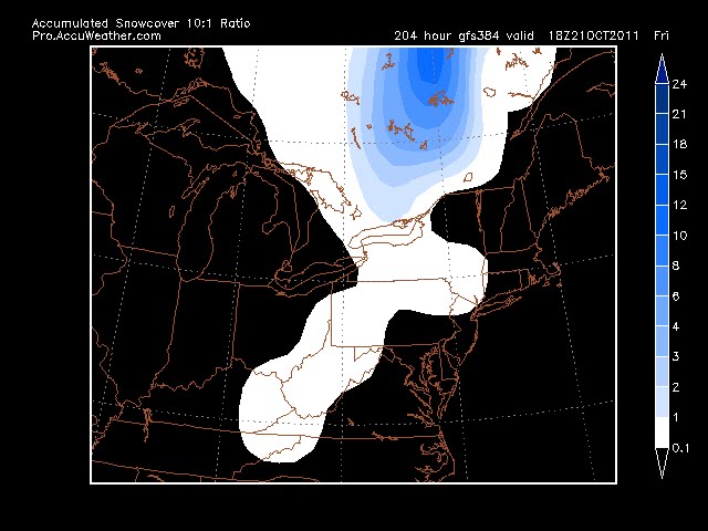
10/21
No go for the 21st, but real promising for around the 29th. Yesterday's euro had the trough lifting out with the gfs having the trough digging in (btw - euro had no rinna, gfs and every other model did). Today, euro flips to the deep trough with rinna riding just east of the coast, drawing cold air in, as does the 0z run of the gfs. Look for snow in the air, perhaps coating if the cold air can come in. Temps are in the mid 30's though. Other issue is that this is a warm to cold air scenario which doesn't usually produce much for snow as the moisture leaves before the cold air arrives. But there is a 980 low off the coast, so....

Euro 10/21 for 10/29

GFS 10/21
------------------------------------------------------------------------------------
 GFS
GFS Euro
EuroGFS and Euro agree on some snow in the region on 10/21, although not sticking and probably not making it into Danbury. Something to keep an eye on as its the first run I've seen snow on (not that I've been really looking for it yet).


.gif)

No comments:
Post a Comment