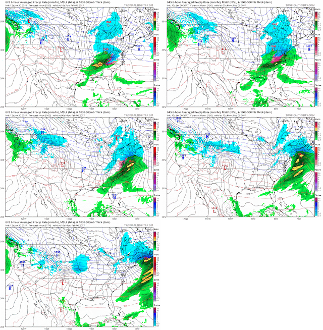
1-22 Complicated system for tomorrow, with models all over. There is no real cold air, though some seasonal air is moving down New England. Thats enough to bring the surface to 850 layer below freezing for far west NJ and North of the Merrit. So we could see a 3-6 hr period of sleet, but the precip amt forecasts are all wacky. Also during that time frame, there isn't that much precip. Winds will be the worst part - these gusts are in kts, so multiple by 1.15. Yes that is 60-70kts over the ocean.
 |
| NAM Winds |
 |
| GFS winds |
|
12z Euro printout
ECMWF Deterministic FORECAST FOR:  LAT =  41.38  LON =  -73.46

                                            12Z JAN22
                 2 M     850     SFC     SFC     700    TOTAL    500    1000
                 TMP     TMP     PRS     RHU     RHU     QPF     HGT     500
                 (C)     (C)    (MB)    (PCT)   (PCT)   (IN)    (DM)     THK
SUN 12Z 22-JAN   4.7     6.5    1007      99      46    0.00     555     550
SUN 18Z 22-JAN   9.0     5.2    1007      85      55    0.01     555     549
MON 00Z 23-JAN   6.8     4.9    1009      87      75    0.05     554     547
MON 06Z 23-JAN   4.1     2.7    1011      86      70    0.05     554     545
MON 12Z 23-JAN   3.1     2.1    1012      78      70    0.05     555     545
MON 18Z 23-JAN   2.9     0.9    1009      71      78    0.05     555     547
TUE 00Z 24-JAN   1.4    -0.7    1007      96      98    0.15     553     547
TUE 06Z 24-JAN   1.9     0.0    1000      97      90    0.69     549     549
TUE 12Z 24-JAN   3.4     5.1     997      90      95    0.85     548     551
TUE 18Z 24-JAN   3.6     6.9     995      81      92    0.88     547     551
WED 00Z 25-JAN   0.7     5.6     999      92      94    0.99     548     549
WED 06Z 25-JAN   1.4     4.2    1001      80      84    1.03     549     548
Which is different from the 0z
ECMWF Deterministic FORECAST FOR:  LAT =  41.38  LON =  -73.46

                                            00Z JAN22
                 2 M     850     SFC     SFC     700    TOTAL    500    1000
                 TMP     TMP     PRS     RHU     RHU     QPF     HGT     500
                 (C)     (C)    (MB)    (PCT)   (PCT)   (IN)    (DM)     THK
SUN 00Z 22-JAN   6.4     4.8    1009      94      14             562     554
SUN 06Z 22-JAN   4.5     5.7    1008      99      18    0.00     558     551
SUN 12Z 22-JAN   4.7     6.0    1007      99      60    0.00     555     549
SUN 18Z 22-JAN   8.5     5.3    1007      86      64    0.00     555     549
MON 00Z 23-JAN   6.6     5.3    1009      86      67    0.00     555     547
MON 06Z 23-JAN   3.6     2.4    1012      84      68    0.00     555     545
MON 12Z 23-JAN   2.5     2.9    1011      80      82    0.01     555     547
MON 18Z 23-JAN   2.9     0.0    1006      73      84    0.02     554     549
TUE 00Z 24-JAN   2.0     1.1    1004      94      98    0.14     551     548
TUE 06Z 24-JAN   2.2     1.7     997      98      98    0.81     547     549
TUE 12Z 24-JAN   3.3     7.3     993      95      98    1.13     545     551
TUE 18Z 24-JAN   4.0     6.0     992      95      53    1.39     541     548
WED 00Z 25-JAN   1.5     1.4     998      92      82    1.47     541     543
WED 06Z 25-JAN   1.1     0.9    1001      78      77    1.49     545     544
vs the GFS
GFS 0.5 Degree FORECAST FOR:  LAT =  41.38  LON =  -73.46

                                            12Z JAN22   * - APPROXIMATED
                 2 M     850     SFC     SFC     700    TOTAL    500    1000
                 TMP     TMP     PRS     RHU     RHU     QPF     HGT     500
                 (C)     (C)    (MB)    (PCT)   (PCT)   (IN)    (DM)     THK
SUN 12Z 22-JAN   3.0     6.1    1007      98      45             556     550
SUN 18Z 22-JAN   9.9     4.9    1008      86      57    0.00     555     549
MON 00Z 23-JAN   6.2     4.3    1010      91      70    0.02     554     547
MON 06Z 23-JAN   4.7     0.5    1012      88      80    0.02     554     545
MON 12Z 23-JAN   2.9     2.0    1012      84      95    0.03     555     545
MON 18Z 23-JAN   3.4     2.2    1011      75      81    0.04     555     547
TUE 00Z 24-JAN   2.0    -0.9    1007      87      85    0.12     554     548
TUE 06Z 24-JAN   4.0     1.7     999      93      96    0.47     549     551
TUE 12Z 24-JAN   4.7     4.5     996      94      93    0.77     547     550
TUE 18Z 24-JAN   5.4     4.8     996      93      81    0.78     546     549
WED 00Z 25-JAN   3.1     5.3    1000      91      99    0.81     549     549
VS the colder 18z with less precip (.65 now)
GFS 0.5 Degree FORECAST FOR: DXR    LAT=  41.37 LON=  -73.48 ELE=   456

                                            18Z JAN22   * - APPROXIMATED
                 2 M     850     SFC     SFC     700    6 HR     500    1000
                 TMP     TMP     PRS     RHU     RHU     QPF     HGT     500
                 (C)     (C)    (MB)    (PCT)   (PCT)   (IN)    (DM)     THK
SUN 18Z 22-JAN   9.6     5.1    1007      88      56             555     549
MON 00Z 23-JAN   6.3     4.8    1009      90      74    0.01     554     546
MON 06Z 23-JAN   4.8     0.9    1011      87      69    0.01     554     545
MON 12Z 23-JAN   2.9     2.1    1012      84      98    0.01     555     546
MON 18Z 23-JAN   3.2    -1.0    1010      78      92    0.01     554     545
TUE 00Z 24-JAN   2.2    -3.3    1006      88      91    0.06     552     547
TUE 06Z 24-JAN   4.2     2.6     998      92      99    0.33     549     551
TUE 12Z 24-JAN   4.1     4.6     996      92      95    0.19     546     550
TUE 18Z 24-JAN   4.4     4.7     996      92      99    0.03     545     549
WED 00Z 25-JAN   3.0     3.7     999      90      84    0.04     546     547
Lastly the NAM wih 1.21
NAM/WRF 40Km FORECAST FOR: DXR    LAT=  41.37 LON=  -73.48 ELE=   456

                                             1P JAN22
                 2 M     850     SFC     SFC     700    6 HR     500    1000
                 TMP     TMP     PRS     RHU     RHU     QPF     HGT     500
                 (C)     (C)    (MB)    (PCT)   (PCT)   (IN)    (DM)     THK
SUN  1P 22-JAN  10.9     5.3    1007      86      54             554     549
SUN  7P 22-JAN   7.7     4.6    1008      86      57    0.01     554     547
MON  1A 23-JAN   4.2     3.1    1010      90      63    0.01     554     545
MON  7A 23-JAN   2.3     1.5    1012      89      79    0.00     554     545
MON  1P 23-JAN   1.7     2.8    1010      84      85    0.01     555     547
MON  7P 23-JAN   1.4     0.6    1007      88      97    0.22     553     548
TUE  1A 24-JAN   1.4     1.6    1000      87      98    0.39     550     550
TUE  7A 24-JAN   1.6     2.8     998      89      92    0.47     547     549
TUE  1P 24-JAN   2.3     7.3     998      89      94    0.05     549     551
TUE  7P 24-JAN   1.3     6.9    1002      88      94    0.08     551     549
@############$@#$@#$@#$@#$@#$@#$@#$@#$@#$@#$@#$@#$@#$@###############
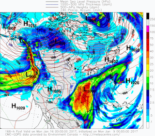
1-20 This time frame remains fairly unremarkable today and yesterday. Still some hints of a storm popping off the coast, as well as some light snow disturbances, but the cold air charge seems to suppress the storms for the most part. Meanwhile on the 23rd-24th we have what should have been the pattern changing storm and its a doozy. 979 LP on the NAM over the SE, but mostly rain in our area with some change to wet snow later to our N and in higher elevations. No real major accumulations right now, but trend is colder.
1-18 Long range models have had a change of air mass pegged for this time period, preceded with a big "warmer" storm. Time to take a closer look now that we're ten days out.
 |
| 12z Euro |
 |
| 6z GFS para |
 |
| 0z gfs para |
 |
| 12z gfs |
 |
| 18z gfs |
 |
| GFS ens |
So the Euro is a Miller A, big storm coming up from the Gulf. The GFS has a cutter on the 25th to 27th which leads to a clipper or Miller B as portrayed above. Prior to today's runs, the Euro and GFS had all kinds of kooky solutions with storms going northwest, swirling around, stalling. It looked really odd. Today its straightening out. Some of the storms going through the lakes are coming east. I like the Euro run better than the gfs, though the ensemble doesn't support the idea of a Miller A.


.gif)
