1-14 -
Ended up with an inch!
Afternoon Smells and feels like snow. Could get a dusting based on radar but the HRRR has it all heading SE and missing
1-12 Euro still has very little north of PHL. GFS as well. NAM is further north, which is usual. GFS Parallel is similar to the NAM which is odd. UKMET is just rolling in. CMC is still south of the area, but north of where the previous run was.
1-11 Euro showing the front sagging to VA and the waves moving along there. The EPS spreads some precip our way, but not enough to cover the ground again. Long range EPS has no snow through the 28th.
GFS 0z and 6z shows similar to Euro - waves moving south of the R/S line over VA with a bit of precip nicking the tristate. No other snow through the 27th.
Canadian shows no snow through 10 days.
GFS para is the only model with snow for us. JMA does hint at it.
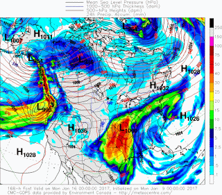
1-9 This mornings low was around -4. Coldest of the year. For this week coming up, we have a warm front coming through which may provide some snow or ice, but not a lot. We have a Great Lakes cutter providing that warm front, followed by a clipper that meets some energy from the south and heads up west of NY which provides another warm front, then a cold front after it passes. That cold front hangs and where that happens determines what happens next as waves progress along the front.
Canadian showing a moderate snow event. Precip map shows what has fallen prior to the 850 temp map below it. So for most of the tristate north of Trenton we should see 2-4 inches of snow.
Euro operational is a tad warmer, but heavier precip, so roughly the same result, perhaps closer to 4". Surface temps are near or below freezing during this time. Euro ensembles are a bit colder and drier.
GFS is colder and drier with the front a bit south
Provide a summary of the model runs for storms which may affect Fairfield County. Not a forecast, but summary of trends, positions and precip type/amount
Monday, January 9, 2017
-
11/27 update - happy thanksgiving. GFS has gone from major noreaster, to huge cutter to lakes and now has a minor clipper system sinking do...
-
2/9 Set up is an upper low over TX that heads northeast into TN valley and then transfers off the coast. At the upper levels, there's ...
-
2/22 - results 5.25 inches. Snow started at 2, lasted 12 hrs with varying intensity and types of snow. Kudos for the models, weather serv...


.gif)

No comments:
Post a Comment