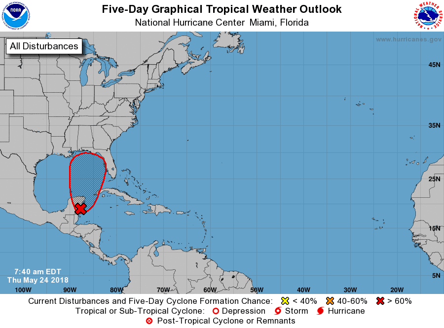
5/24 - We may have our first system this weekend along the gulf coast'
Rain is likely to be the biggest problem with Euro and GFS showing over 10"
Wind gusts under 70mph for now
5-14 NHC has downgraded this to a 30% chance of forming.
5-11 GFS has been adamant forming a low off the Yucatan and bringing it up, but it remained alone until the NAM run.
5-4
Upper low responsible for this, so not technically tropical. Should ride up coast over next 48 hrs and either just miss or hit us on Sunday. GOES EAST is up and running on some of its tropical sectors.
Here's a look from the Carribean sector.
Provide a summary of the model runs for storms which may affect Fairfield County. Not a forecast, but summary of trends, positions and precip type/amount
Friday, May 4, 2018
-
11/27 update - happy thanksgiving. GFS has gone from major noreaster, to huge cutter to lakes and now has a minor clipper system sinking do...
-
0z above with explosive development 12 z below prior to explosive development While the October snow was certainly impressive and rare, a r...
-
Without any real cold air around, this one looks to be mostly rain for CT. The models are not in alignment: GFS - furthest south with low ov...


No comments:
Post a Comment