Saturday, December 4, 2021

First accumulating snow of 2021?

 12/8  Storm is whiffing to the south and east. Ukie is just outside BM closer to 38/70

Euro is further south at 37/70

GFS even further south


NAM furthest north - all is in order


There's a warm air advection chance of snow Thursday then it warms up.  Not much in the way of anything otherwise during the next two weeks.  


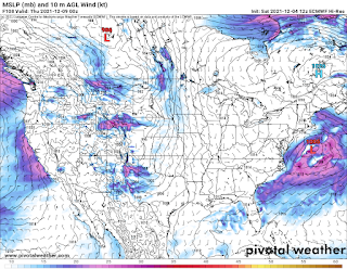
12/4 Looking at 12-8 for the first snows.  This has been on and off for the last 10 days or so on the models and they are starting to consolidate somewhat.  UKMET and the Euro are oddly the furthest east while the GFS and NAVGEM are furthest west.  All but the NAVGEM bring minor accumulating snow to the tristate area, in some cases even to the shore areas and LI. 


Ensembles are starting to consolidate. 


Things missing are really cold air and something to slow it down or make the trough go negative. GFS has it going from snow to sleet/rain, NAV is mostly rain, UKIE and Euro are mostly snow, but more of a glancing hit as they are further offshore.  GFS skew shows that the surface temps aren't the problem for north of the Merritt, but that there is a warm pocket around 800mb that melts the snow and refreezes as it falls in the layers closer to the ground.  Temps should be around 30-32 for the event at the surface, mabye 33.  It's not a terribly dynamic storm, so faster moving and weaker, but still noteworthy as its our first real chance at accumulating snow for this season. 


Saturday, January 30, 2021

February 1-2

This was the result.  Not bad - LI /CT stayed snow further east than expected. I'd give me an A-


1-31 

The north trend stopped, though I'm sticking with it.  Still not convinced it doesn't mix NYC east and south of Trenton.  There have been some breathtaking model runs today that really make me think I've underdone this.  Trying to figure where the heavy band will set up is like trying to figure out where the heaviest thunderstorm will be a day before.  Based on the upper level low placement, and the progged vertical velocities, I like the red area as having the most chance of being over 18" with some areas getting 24-30" in the hash.  But not surprising if that  hash area shifts east into Bergen or even Westchester, or if the western edge sags down a little.  Mitigating things in SNJ, ELI and SECT/RI/Cape is that there will be some snow, then it mixes and rains.  The low is hugging the coast for most of the heavier precip and that just brings the warm air in.  We may even be dry slotted and go to freezing drizzle as far west as Fairfield County and NYC. 

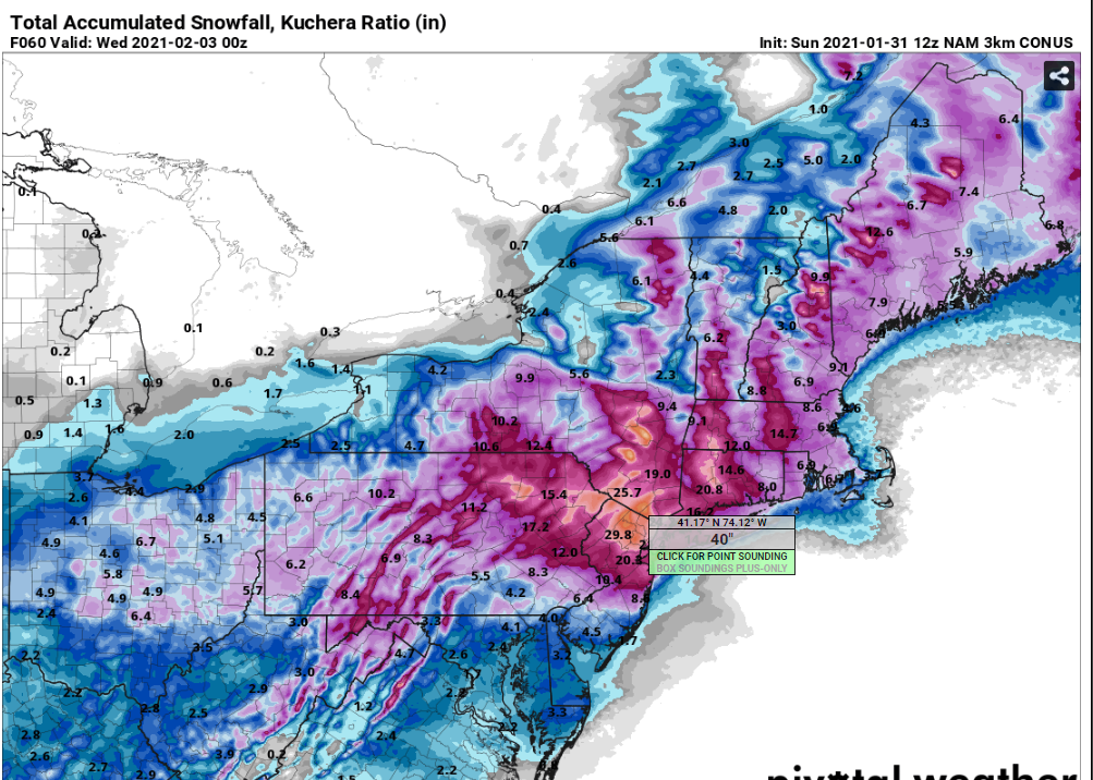
But the models are putting out crazy amounts. Like this one from the Regional Canadian (NAM) with 50".  


Or the NAM with 40"


Even the GFS as I'm drafting this came in with some big numbers


This was issued at 330 this afternoon


1-30  First snow map is below.  The amounts are higher than the NWS forecast currently, but less than the highest models.  The area of heavies snow is purposely north as we've seen this happen before. It is likely I will extend the 10-18 further south.


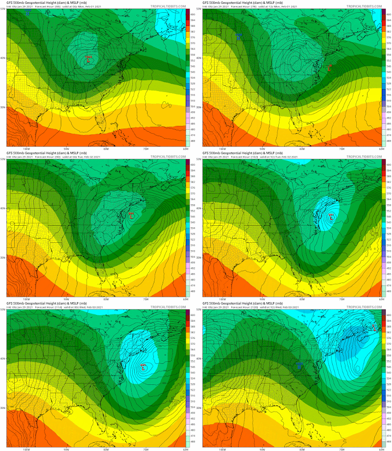
1-29 This starts off as a low coming across the country, dropping a swath of 12" across the midwest before it dies out approaching the Apps and reforms off the Carolinas.  Initially the models had the transfer taking place closer to SC than NC, but that has since shifted back to the typical OBX to 40/40 benchmark track.  

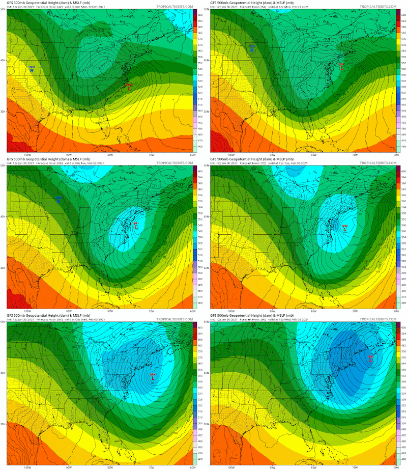
Complicating this standard Miller B storm is that an upper low is coming behind it which will "capture" the low and slow it down.  Models having a problem trying to figure what happens to the low, with some stacking them, others putting low to the east or south.  Typically the low either stacks or stays to the east and moves with the upper low.  However, some models, had the low looping and heading south and then east.  This is not common.  Stalling, yes, but a loop that big is a red flag that the model can't figure which surface low to follow.  The shaded area is the 500mb low.

Low going wrong way

Here is a more typical scenario


But today that seems to be resolved.  The low is coming off NC by OBX, moving northeast (not east), getting captured by the upper low and then moving northeast.


Now that the models agree on the set up, it comes down to positioning of the lows (upper and lower) and that will remain a challenge through the weekend.  Here is where we are right now with the 12z Sat model trends. You can see what we call the windshield wiper effect as the snow shifts south, then back north.  This is pretty typical. Additional shifts are likely but should be less dramatic.  Also note the Canadian's precip output is insane.  But its not impossible, and that area may not be the one to get it. 

Euro


GFS

A little early for the NAM but so far

and Canadian


Tuesday, December 15, 2020

December 16-17

Results:  we didn't get a foot.  10.5" which isn't bad, but not a foot. Some areas in PA/NY/VT/NH got 40+".  Instead the storm came too far north, then dry slotted us.  Heavy band came through around midnight and then just scattered snow showers.  We did not turn to sleet, though it may have mixed. No pinging, no ice on branches, no crusty layers.

Dry slot after midnight

Long loop of storm regional

long loop of storm

SPC evolution of the storm

Then from NJ north


48 hours out the NAM Kuchera map was the closest with the heaviest snows in the right areas, while the fringe areas were a little off. 


=======================================================================

 It's pretty evident we are getting a foot of snow.  Here's the latest maps.  Almost all have at least 10" or more.   Its not a complicated system, just a weak low throwing warm air into a new cold air mass.  No phasing, though a weak upper low is going to stall the storm briefly in the NJ area.  Biggest concerns have been the GFS being so far south, which corrected today. 


So now its whether the track shifts too far north or west, or if it gets suppressed (which is looking less likely). 
So here are the 12z snow maps from today.


Plus the NWS forecast


With the exception of the GFS which pulled north, and the NAM and Icon somewhat pulling north, most runs were very consistent.  QPFs in the 1-1.5"range for most of the tri state with higher amounts on some runs and the nam3k.   Other things to watch are mixing on coast, dry slotting which is showing up in the Nam3k.  Northern cut off will be shar, likely just north of Albany-Boston. 


Feb 25 clipper

 Got a quick 3" in 3 hours this morning Driveway was completely clear