Tuesday, October 9, 2018

Hurricane Michael

10-9

Michael started out with a look at the MJO and EPS probability of tropical development back on Sept 29.
The GEM picked up on it first, but then again it picks up a lot of stuff that's garbage too.  The general theme was development in the western Caribbean and moving either east or west of FL.
Euro had it in the SW Atlantic on the 2nd
Had nothing on its 12z run the 3rd, but the 4th came around to the idea of a panhandle special


From there it became timing and exact placement.

Even the navgem had it on the 4th.

GFS on the 2nd had sniffed it out - but honestly, every run of the GFS this year has a storm in the Caribbean.  It took it around the gulf, then out over Florida
All clear on the 3rd and 4th

By 12z on the 5th it had locked in.
Once we got to the 5th, it really became an intensity and exact location battle.  The area between NOLA and Big Bend were in question.  That got narrowed down to Mobile to Big Bend as the NAM came on board with a Big Bend hit, then it became Pensacola to just east of Panama City. This is where it remains today, with most guidance taking it ashore around Panama City.

As of tonite, the winds look to be in the 120-125 mph range at landfall per NHC. 

10/10  - will fill in at home

Doing this retrospectively.  There was no indication that Michael would go to 155mph until a couple hours before landfall.  It just kept strengthening.   These are the hurricane hunter obs.  Some of the flights were at the same time, so its not in perfect order, but you can see the history well here. 


Radar from landfall and satellite


NHC Forecast
Track was nailed down pretty early, at least early enough for watches and warnings.  The intensity forecast was the problem.  NHC started its forecast with 65mph winds but mentioned HWRF is more intense. 

By Sunday night the intensity was raised to 100mph.  HWRF was still noted as being more intense but discounted due to the shear that would be around. By Monday 4am, the first discussion of major status came around.  Still noting that there was a lot of shear. The next update was the first to go to major status, with 120mph winds.  The inner core was developing strongly and was able to fend off shear.  
Now that Michael has developed an
inner core, steady to rapid strengthening is predicted during the
next 24 to 36 hours.  The SHIPS Rapid Intensification Index and
DTOPS give a 55-60 percent chance of rapid intensification during
the next 24 hours.  The updated NHC forecast is near the upper-end
of the guidance and calls for rapid strengthening over the next 24
hours, and brings Michael to major hurricane status. 
The 10pm Monday discussion says it all
Michael's steady intensification over the past 48 hours in the face
of 20-kt westerly shear defies traditional logic. Either the shear
calculations are unrepresentative or Michael has become more
inertially stable due to its large eye and large outer wind field,
making it more shear resistant. Having said that, all of the model
guidance calls for the shear to decrease to around 10 kt or less by
36 hours, which argues for at least steady intensification during
that time given that Michael will be moving over warm SSTs of
28.5C-29C, which are about 1-2 deg C above average for this time of
the year.
The prediction remained in the 120mph and 125mph range until the 10pm Tuesday advisory which increased winds to 130mph.  At this point the pressure is 947mb.
Satellite intensity estimates from TAFB and SAB, along
with objective estimates from UW-CIMSS ADT and NHC, support an
intensity of 115-127 kt. However, those also estimates also would
support a central pressure of about 935 mb, which the aircraft has
not measured thus far
The 4am advisory, 8-10 hours before landfall, brought the forecast wind speed to 145mph.

Models.
HWRF was said to have done the best.


I could only go back so far.  Track was pretty tight with the models, making a call for a landfall in the Panama City area easy 3 days before, though the NAM had a sharper west turn and hit Big Bend area.  With the approaching front/trough it was something to watch.

Globals showed intensification as it approached land, but were way off with their pressures and winds.

10/11  Aftermath


At 200 AM EDT (0600 UTC), the center of Tropical Storm Michael was
located near latitude 37.3 North, longitude 75.1 West.  Michael is
moving toward the northeast near 25 mph (41 km/h).  An east-
northeastward motion with a significant increase in forward speed is
expected during the next couple of days.  On the forecast track, the
center of Michael will move away from the coast of the United
States during the next few hours and then begin to race
east-northeastward across the northwestern Atlantic Ocean.

Surface observations indicate that maximum sustained winds have
increased near 60 mph (95 km/h) with higher gusts.  Michael is
expected to continue to strengthen while becoming a post-tropical
low during the next few hours.

Tropical-storm-force winds extend outward up to 275 miles (445 km),
primarily over water to the southeast of the center.  The National
Ocean Service station on the York River recently reported sustained
winds of 62 mph (99 km/h) and a wind gust of 83 mph (133 km/h) at an
elevation of 48 ft (15 m), while the Norfolk Naval Air Station
reported sustained winds of 54 mph (87 km/h) and a wind gust of
75 mph (120 km/h).  Also, a Weatherflow station on the Chesapeake
Light Tower recently reported sustained winds of 81 mph (130 km/h)
and a wind gust of 96 mph (154 km/h) at an elevation of 135 ft
(41 m).

The estimated minimum central pressure is 985 mb (29.09 inches).


Post-Tropical Cyclone Michael Discussion Number  23
NWS National Hurricane Center Miami FL       AL142018
500 AM EDT Fri Oct 12 2018

Satellite imagery and surface observations indicate that Michael has
become a storm-force extratropical low as it moves off of the coast
of the United States.  The initial intensity has been increased to
55 kt based on the surface observations, and some additional
increase in strength is expected during the next 12-24 h.  After
that time, the cyclone should gradually weaken, and it is forecast
to dissipate over the eastern Atlantic by 96 h.  The revised
intensity and size forecast are based mainly on the guidance from
the Ocean Prediction Center.

Michael flooded LI with 4-5 inches of rain as it skirted to the south.  We had no rain overnight here in Newtown


Tuesday, September 18, 2018

Florence Wrap up

9-18

Florence's remains are headed out of New England today.  She struck Wrightsville Beach Sept 14 at 7:15am with 90mph winds and 958mb pressure.  NHC landfall announcement


Storm surge was estimated at 11ft, but I don't have actual verification of that yet.
Rainfall was up to 50"  - many rain gauges failed, pws were out because of power, and manual gauges weren't emptied on time.

There were pws winds of 112mph, Wilmintgon NC Airport (ILM) had a 105mph gust,which was its highest wind since Helene in 1958 NWS ILM PIS on Winds


Flooding was widespread.  Rainfall as of the 17th below - keep in mind the gauges weren't emptied right.
This is the tweet on radar estimates.

A closer look with 30-50" in areas - we may never know
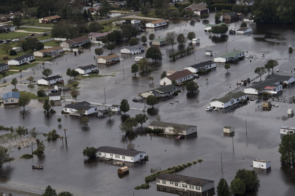
This left massive flooding...


Rivers rose to historic levels - surpassing Matthew and Floyd.  NWS put together a nice comparison in their chart, and many places haven't seen their rivers crest yet.


Thursday, September 13, 2018

Florence day 9 - current cat 2

9-13  Florence will not hit as cat 3, maybe only cat 1, but still bad effects.  Such as surge - Wrightsville Beach to be covered over.


And Rain - GFS and NAM keep it around for 48 hrs and generate similar rainfalls.  The NAM ends while its still raining over the NC coast.  45" of rain not out of the question if this thing stays around like modeled.  Actually, the models only had Harvey with 30", so they may be underdone here.


 The storm continued to weaken after an eyewall replacement cycle. NHC pointed out there was some southerly shear, which many of us on WXDisco were pointing out, but others said not to count it. Dry air is also an issue.  But the air really isn't that dry.  This is the lower level wv shot this morning.  Below that are the modeled humidity of the surface, 3000 feet, 5000 feet, 10,000 feet, 30,000 feet.
And the precipital water (how much water is in the entire column of air) which is fairly wet for the entire east coast.
My guess is that some dry air kept managing to get into the storm at 5000 feet or 25000 feet. Intensity is definitely hard to predict - there wasn't any hint that it would decline this much in the last day and a half.  We did expect it to start declining right about now as it approached.  The ADT history below is a good representation as to its weakening. There was also a upper level low over FL which provided some shear, but really these factors were so minor compared to the last time she declined.
So the good news is she's weaker.  This of course means the hurricane winds are spread out more, but they are actually shrinking as well compared to earlier.  Here's an estimate of those.  TS storm winds are about 300 miles across.
It seems it will hit Wrightsville Beach, which is ironic.  But may still end up a bit north.  The call for Cape Fear to Cape Lookout was good.  Looking like its WNW movement now

Cool satellite picture

Compare this loop to the one from 12:15 above.

Tuesday, September 11, 2018

Florance day 7

9-11  Still no changes....still unsure where she goes after "landfall".

Scratch any references to the Wilmington to Wrightsville in previous posts.  I meant Wilmington to Morehead City, thinking thats where Wrigtsville beach was. But Wrightsville and Wilmington are essentially the same area. 

Still looking at a Wilmington hit. Worst part between Wilmington and Wrightsville.  Big question is once it gets there or just short of there, where does it go.  The stall and SW move into SC are popular now with the models.  Seems odd to me.

We saw some changes in the structure today -an eyewall replacement which saw the diameter of the eye go from 12 miles to 34 miles.  Best seen on mimic. Watch the inner eye wall dissolve and be replaced by the outer one.
This is what the eye looked like late this afternoon.
Some fluctuations in strength will occur prior to landfall due to these eye wall replacements.  Its a sign of a mature storm

Tracks are still taking the storm to somewhere between Wilmington and Diamond Shoals, depending on which model run.  Then once it gets to that area, sometims it slows then progresses inland, sometimes it loops, sometimes it drifts south.  There are no steering currents around and to say where exactly it will end up is just impossible.  That it remains in one area will help it weaken - if over land it will weaken rapidly, whereas if over water, it will churn the water up and cool it off, taking away its fuel. My new favorite model site is the U Albany site which has a great summary of all the operational tracks.  These are the 0z and 12z runs. I highlighted the area where the storm will slow. Black line is the NHC forecast. 


Much of the east coast had coastal flood warnings last night due to an easterly fetch persisting. Hwy 12 was overwashed.  Add to that swells from Florence and those warnings remain in effect for the tidewater area and Chesapeake Bay.  Now add in 20-30ft waves as mentioned in the discussion from the Morehead NWS office ( link  ) and a storm surge of 9 to 13 feet, winds over 100mph, staying along the coast will be life threatening.  This isn't just for 3 hours or 6 hours - the storm is modeled to sit for 24-48 hrs.  Now do I believe that?  Not sitting offshore, but I could see a situation similar to Harvey. 

A quick look at the latest HWRF and HMON while I'm here.  These are the US hurricane models, designed to deal with hurricanes. The Deterministic/Operational models like the GFS don't get intensity very well as I described last night.  HWRF has 120kt winds right before landfall, which is 138mph, sustained winds, not gusts.  Gusts might be 160mph.  It keeps the storm moving though.

And the HMON which is roughly 110mph at landfall, having dropped from 110kts to 90kts on the approach.  I add 5mph as the area with the higher winds is already ashore in this frame.
As I wrap up, there seems to be some degradation to the storm, perhaps another eyewall replacement like last night.  Or a lot of prayers.


Sunday, September 9, 2018

Florence Day 5 & 6

9-10  Fun day.  Watched a cat two storm this morning go to a cat 4 storm in the afternoon

Odd thing is no real changes.  Arrival time is Thursday late afternoon or overnight.  Target area is still Wilmington to Diamond Shoals.  Models have moved around somewhat, but nothing to make me change my mind.

This storm will be dangerous.  I question if the operational models (GFS, Euro, CMC, UKMET) really grasp the strength.  Euro, for example, has landfall at 77mph.  Its peak wind speed on the way to the coast is 91mph.  Its 140mph now.   Here are some other comparisons
For the record....
  • 12z GFS has the pressure at 0z (8pm edt) at 955
  • 12z FV3 has the pressure at 0z at 961
  • 12z cmc has it at 992
  • NavGem at 996
  • Icon at 982
  • JMA is at 1002 tomorrow morning
  • UKMet I don't have updated for some reason.  If anyone has it for 0z from the 12z run let me know
  • Euro at 974
  • HWRF at 0z  is 942
  • HMON is 946
  • NAM32k is 971
 Pressure at 8pm was 943mb. 
This makes me want to consider the HMON and HWRF, both of which hit the targeted areas.  HWRF is really bad coming close to landfall with 122kt winds (about 140mph).  HMON is more reasonable at 100kts (115mph)

GFS is still goofy with it not making landfall, stalling, looping and gaining strength even though its churned up all the warm water.  Then it loops SW and makes landfall. I'm ignoring the GFS once that happens - so I'll consider the track up to the stall and loops.

I do expect the storm to slow or stall once landfall occurs, but not out at sea.  The details as to what happens after landfall still need to be worked out.  There should be massive flooding. I like where the rain is on the Euro, I just think it may be almost double what it says.  Yes, up to 30" over interior NC and/or VA.  We'll figure out the stall tomorrow or wednesday.


I found this picture to be a good summary of the tracks.
http://www.atmos.albany.edu/facstaff/tang/tcguidance/al062018/


9-9 night
Well, we've reached the point where we're looking at a landfall that's 96 hrs or so away.  4 days.   Model guidance is remarkably consensual. You've got the CMC, NAVGEM, Ukie, Euro, AVN (GFS), two hurricane models (HMON, HWRF) and even the NAM showing hits on or near NC.  I don't remember seeing this far out such consensus.


Even the NHC hurricane models are remarkably, eerily, similar.


Which begs the question - what can go wrong?
We know there's not much in the way of steering currents once it gets this far, so there's that randomness at play
We know there's warm water. We know there's supposed to be little shear. So intensification is likely. But how much?  Is there an ERC?
There is a random trough out there (c) which may mess things a little, but its fairly weak. As well as an upper low (D). Those are supposed to disappear.
There's two systems down stream which could push back further.  A&B
There's the H near Cuba (E) which could erode some and have Flo drop down, or push up some.
There's the stationary front we are currently dealing with  (F) - does it push south more, retreat further west  or just dissipate.
9-9 10pm water vapor


Then there's the future - does that Atlantic Upper High (A) build and or orient as expected and then slide under.  Do the other upper highs (B&C) do enough to prevent Flo from coming inland
And does the kicker (D) come into play, or are we relying on the westerlies (E) from the system coming into the PacNW to eject her. 


 I can't imagine the forecast staying the same for the next 72 hrs.  But how will it change?

9-9  Morning
Not sure how much will be updated through the course of the day.

Still focusing on a NC hit. Leaning toward Wilmington/Wrightsville to Cape Lookout. Can't rule out a Myrtle Beach yet based on the UKMET and NAVGEM.  But I like the idea of more of a bend north out of this as it nears the coast than the UKMET suggests, really just based on history.  Also can't rule out that it just about makes it to the OBX before a stall as GFS runs have suggested.  I'd be ready to move if anywhere from south of Chesapeake to Myrtle Beach.

Intensity should be in the Cat 3 range. I do think it hits as a major, and I don't see anything slowing intensification down as some models do on the way to the coast. I believe only one Cat 4 has hit NC so I'm going to go with history on that and keep it Cat 3.  If Florence hadn't gone through what she just did and could eat up all the energy out in front of her as a Cat 2 already, I'd support a Cat 4 or 5.

Stalling - this to me is the most complicated aspect.  What happens after landfall or does it stall before. Every model supports a stall if the storm is north of Myrtle Beach.  The reason is the dominant high to the east is breaking down and fighting a building high to the west.  The steering on the west side of a high is to the north and the east side to the south.  The storm is caught in between and there is nothing else to guide it.  I believe forward momentum and a stronger high to the east will allow this to keep moving until the westerlies can grab it, but it may move slowly.  If it stalls off the coast, then OBX is pounded with winds over 100mph for 24 hrs, then 90mph for another 24 hrs and over 80mph for another 24 hours.  Depending on location, that may just pile water into the bays in a way never seen before.  On the other hand, if it stalls inland, 20+ inches of rain is possible. 

Affects - most of the wind is coastal on all models.  Some gusts to 120-130mph would not surprise me, but again its mainly the coast.  Tidal surge is a problem.  I expect OBX to be covered, at least as far north as Diamond Shoals, but the entire length if the GFS has its way.  The problem as mentioned above is rain and prolonged wind if it stalls.  No stall and the coastal plain sees 10-15" of rain.  A stall could put 45"+ of rain over the coast and 20+ inland.  One recent model run had 95" offshore.

Some results from the 0z/6z  runs - keep in mind these winds are gusts, not sustained. Hurricanes are categorized by sustained winds.  Gusts, however, can do just as much damage.

0z GFS stalls just off the coast

6z GFS stalls just inland

A closer look at rainfall on the GFS 6z - yes thats 50" of rain


0z Euro further south, and stalls further inland


Feb 25 clipper

 Got a quick 3" in 3 hours this morning Driveway was completely clear