10-28 afternoon. 12z Euro gusts are out of control. Has to be something wrong with the output.
10-28 Not too much in the way of changes. Track is narrowed between E.PA and E CT. What exactly happens with the tropical system needs to be worked on. Does it remain an entity and hit the Cape and Islands, or does it lose its energy to the low going up NJ into PA/NY . Some precip maps.
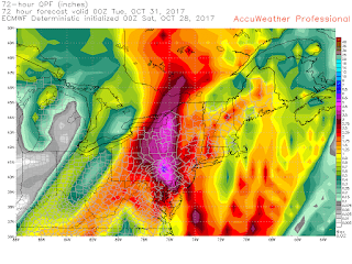 |
| Euro precip |
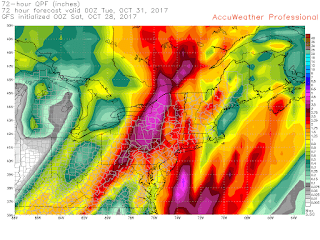 |
| GFS precip |
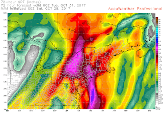 |
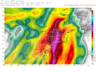
| Nam precip |
 |
| Nam 3k |
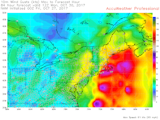
Winds still a concern, particularly east of the CT river, but that could bleed to the NY/CT border. LI is also vulnerable.
A closer look at winds in Southern new england
 |
| Euro gusts |
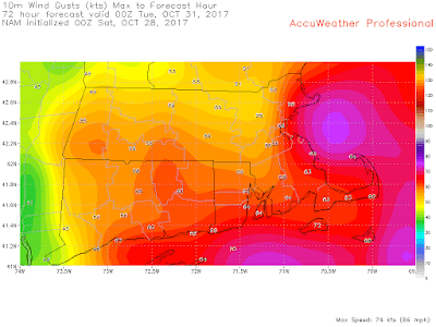 |
| Nam gusts |
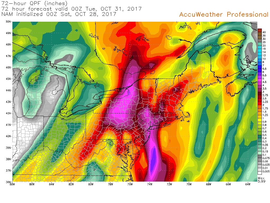
10-27 Been watching this one develop for a week now, with fairly consistent big picture trends but details still a bit off. Idea behind this one is a tropical system start developing off Central America and quickly moves north, crossing Cuba/FL. Whether this is named or not doesn't matter. Even if its just an amorphous blob of moisture, it will do its job. At the same time this entity moves NNE, an energetic upper low drops out of the upper plains into the TN valley area and spawns a low pressure system which merges with the unnamed tropical system. The position of the ULL draws that system up the coast. The Euro has it as a 980 low going parallel to NJ and up the Hudson Valley. The NAM a 976 low over LI/CT and the GFS targets SE Mass with a weaker 992mb low.
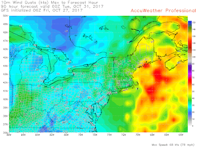
The differences in track, though not off by much for a fall storm, brings much different scenarios to areas. GFS focuses most of the precip east, euro west, nam down the middle. Winds are east on NAM and GFS, over CT on the Euro.
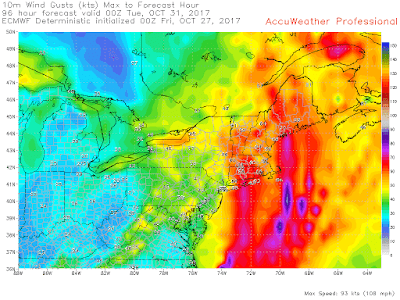 |
| Euro gusts |
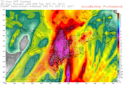 |
| Euro Precip |
 |
| GFS gusts |
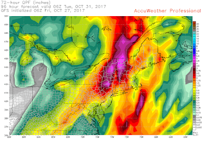 |
| GFS pecip |
 |
| Nam Gusts |
 |
| Nam Precip |
Other models: JMA looking similar to Euro precip wise. CMC I'm tossing as it develops the tropical system (as usual) and has it hit ACK as a hurricane. NAVGEM on the other hand doesn't develop the tropical system until later, missing the interaction, but the lp spawns anyway and precip looks like GFS, though a completely different set up. UKMET hard to tell with 24 hr gaps, but has low off NJ similar to Euro but looks like its going more of a NAM track.
So big picture, a fairly potent storm coming to the northeast.


.gif)
