8am Danbury - not an impressive snowfall - went to bed at 10 last night, had 11 inches. Just measured now - its almost impossible. Non obstructed measurements ranged from 30 inches to 0. I'm going with 14", despite the "official" 6am measurement was 11.5 at the airport.
What was truly impressive was the wind and its effect on the snow. Three of my first floor windows are partially to fully covered in drifts. Drifts of up to or more than 4 feet surround the house. My driveway, which is sunk into the ground by 4 feet or so is nearly full, which is bad, bad news.
The weatherstripping around a basement window blew in, along with a few inches of snow. The garage, which has a few gaps around the doors, has a few inches of snow inside. I've never seen that before.
The wind is continually pounding the house. My OS weather station routinely under reports windgusts (I'm updating to Davis soon I hope) In the three years I've had the station, I've only had one gust over 30mph. But now they are frequently in excess of 30mph. The ASOS report in Danbury had a gust to 60mph.
Pressure bottomed out at 988, which is not a record, but pretty impressive considering I'm 150 miles from the storm. Temps were frigid, holding in the teens for most of the storm.
So I'm not sure what happened with the snow between 10 last nite and 8 this morning - it looked like we were setup for another foot, it either blew away, or just didn't happen.
Final report - 19 degrees, winds at 19mph gusting at 32 with light snow.
See you next storm.
Monday, December 27, 2010
Sunday, December 19, 2010
Christmas storm (or the day after)
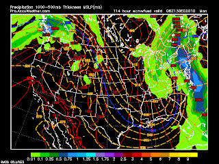
12-26 - NWS has all of the NYC forecast area in a Blizzard warning - expecting 15-20 inches. Started snowing around 11am, very light. As of 1pm (see pic), only an inch.

Latest GFS precip map
___________________________________________________________

12/24 night - 18z runs of Nam and GFS concurred with the 12z gfs. MEts were throwing that run out as well due to bad data. Well I guess the data was bad for the 0z run of the NAm as well. The blue line goes all the way back to just west of the NY Thruway, with Danbury in the 6-10 inch range, or more. Crazy - East Mass is progged for 3" qpf. If that stayed all snow, even with a 8:1 ratio, its at least 24".
Nam has 972 on the BM, with the next spot a 964 low on the Cape. Astounding. Wondering when the NWS will pull the trigger on this instead of making excuses. Or are they trying to drive us nuts!
18z gfs ens have low inside bm, weighted west.
12/24 - afternoon
0z gfs had a nice run with us on the western edge with 6-10 inches
0z euro had placement of low just grazing the BM, but did not put out any liquid.
6 z GFS shifted east
12z GFS crushed us - see pic
12z Euro pushed further east of BM, by about 100 miles
NAM runs started off only major precip 200 miles east. 6z had the blue line on Cape Cod. 12z had the blue line back to Boston
JMA for the first time takes the storm over the BM
12z GFS ens were inside the BM
SREF ens are inside the BM with heavy spread bias west
CMC trended way west - from being 400 miles offshore to 200 miles with bulk of precip. CMC ensembles are pulling almost to the BM
So the consensus would be the adamant OTS models are shifting west, but not enough to affect NYC. The GfS may be messed up, as many are saying it did created a vort max too early.
12/23 - 0z run back on track with .5 precip NYC east to the Cape where its 1.75.
early afternoon
Models trending away
0z gfs had us in the 3-6 inch range
6z gfs pushed back into 6-10 inch range
12z gfs - ots - nada, but some flurries on Christmas nite
0z Euro knocks down to about a foot, perhaps 15 inches - no longer stalls south of li and just plows straight north, inside BM.
12z euro goes from OBX to CCOD, a tad further east. Looks like a decent track, but there is only .01 in precip
All nam runs look OTS
UKMET - OTS
JMA pulled west, but not enough to hit us
DGEX pulled west, but not enought to hit us.
CMA - out to lunch. Doesn't even have a storm


12/21 - now its the day after the day after Christmas.
Low and behold, the GFS blinked. Its 12z and 18z precip runs are right off the coast, within 150 miles of the Euro. Precip images are above. GFS goes to a 976 low, but SE of the BM. Total snow of 2-4 inches
Euro 12z brings it to the mouth of the Delaware and to a 972 low (other sources had 968). Precip for DXR is 1.48, BDL is 1.52. Looking at the 850 temps of under -10C, there would be a lot of fluff, 15 inches per inch of liquid, for close to two feet in most of CT. Mixing should not be an issue either. Winds of 60-70 mph would hit ACK and perhaps the Cape. This situation looks so bad, it can't possibly happen.
Both models have a sharp right turn east south of long island.
While the models tracks are now within 150-200 miles, timing is still an issue. Euro has it snowing in NYC from 0z sunday to 12z tuesday. GFS moves in around 18z sunday and leaves by 12 z monday. Other example, GFS reaches the latitude of ACY at 3z monday. Euro is in the same spot 0z tuesday, almost a day behind.
Other models
JMA - out to sea
Nogaps - out to sea
DGEX - out to sea
UKMET - similar to the 18z GFS - puts a low too deep to register (I see at least a 97X) off OBX at 12z, so its track is like the gfs, but its stronger and slower.
CMC - bouncing around between the euro and the 18z GFs, 0z at BM but the 12z run is way out there giving us nothing
GFS Ensembles - bring the mean barely se of bm. The deepest spread is NW and there seem to be more members leaning west. Precip still at .25-.5, more than the operational.
Euro ensemble mean is east of the operational, with a heavy spread to the WNW.


12/21 - Midday (should be only post) - above are GFS precip maps, 12z Euro and 12z CMC
0z gfs has 1.25-1.5 in precip - beginning Sat morn with it maxing out at 984 just south of LI Sunday afternoon at 984mb. It stalls awhile after that and stops snowing at 156hr Mon morn
6z GFS has under .1 precip, ots to our south. It too has a 984 low a bit further south of LI, but the northern precip really doesn't make it to us.
12z GFS .01-.1 precip, ots to our south. It has flurries on Christmas. 1004 low off VA/NC going way out and improving.
0z Euro has .75-.1 precip with a 970 low going up the coast until Ocean county when it stalls and heads east. Precip looks too light based on that track. Snow not starting until 1pm Sunday/
12z Euro has 1.39 precip with it falling mostly Sun nite thru Monday. It parks a 968 Low right off the NJ coast and spins it out for 48 hrs. Truly amazing to see this - precip is still likely underdone, and with cold enough air, two feet is likely.
0z UKMet - out to sea
12z UKMEt 144 hr (Mon morn) has huge storm blowing up off OBX. May still go out, but not looking like it.
DGEX - out to sea
NOgaps - OTS
Canadian GGEM - similar to Euro. No precip estimates yet. The 0z run took it a little too far inland for my liking, but the 12z corrected east. Like the Euro, it stalls the system. I want to say I counted 54 hrs of snow out of it!
I would speculate that the GFS isn't seeing the northern branch energy coming in yet. Now the Euro is notorious for dragging its heels on systems coming out of the SW, which may explain the 1 day difference. But with the GEM and UKMET having the same look, it may be only slightly delayed.
If you discount the GFS, we have a major snowstorm starting Sunday and lasting through Monday. To be measured in feet.

12-20 evening
Posting above the 18z dgex which shows a 970 low off the coast of NJ . Its timing is slower, not starting until Sunday. The snow map that goes with it has over 15 inches in the tristate area.
The euro is a bit further east and faster now, but just as strong and still delivers snow. Its got 3-6 on the 12z run, compared to 6-12 earlier (and some areas had up to two feet). The ensemble spread is to the nw, but not by much.
GFS 18z run has over a foot in NE NJ and Westchester, with widespread 6-12 elsewhere. Light precip starts early Christmas day, but doesn't become heavy until night. The ensembles are out to sea though, with only 1-3 inches. The spread there is to the west. Odd to see the operational that far to the west, and not a good sign.
UKMEt 12 z never tilts the trough negative and closes off the upper low over PA, which normally is good, but it looks like the surface low escapes. But it only goes out to 144.


12-20 mid afternoon
Map of Euro solution and the precip map from GFS are above.
Looks like snow on the 26th, but just a matter of how much.
Euro solid on, a little too far west for us with the ensembles and their spread is to the north. Operational has a 980 low parked just south of LI by 0z 1/27. So its timing is more on the 26th than on Christmas
CMC - 0z brings a 993 Low off Delmarva at 144hr (8pm Christmas night). 12z run shoves it off to sea, whitening VA and NC.
DGEX puts 994 low off NJ by Christmas night, but heads it straight out, brushing CT.
UKMEt looks out to sea at 144hr
JMA - out to sea
GFS oz brings low out NC/VA border by 7am Christmas, only intensifies to a 992 just barely se of the bm by 7am the 26th, brushing the area with snow, but heavier in S NJ.
6z almost same track, a little slower and at 984 by the BM. Oddly, snow stretches back into all of NJ, but stays south of CT
12z low hits NC/VA coast 1pm on Christmas, heads out east a bit, then turns due north, over bm at 980 by 12z Sun. Results in fair amount of snow - 3-6 inches in NYC area, more in NE CT.
_______________________________________________


12-20
A day behind, but there is a chance for our real first snowfall to occur within 24 hrs of Christmas. GFS has been on this for all its runs, no switching between 6 & 18 v. 0 and 12. Euro is on board too. UKMET looks like its headed in this direction.
Posted are the GFS and EURO models. GFS precip is about 1-1.25 inches, so sizable snow, if indeed it falls as all snow. JMA suppresses the storm too, which is only interesting because its the only model who didn't crush the NE with snow today. Although, it did forecast a small amount.
Big fear of mine is that the storm phases too early, becomes to strong and brings in warmer air. Resulting in a snow-rain-snow combination.
Latest GFS precip map
___________________________________________________________
12/24 night - 18z runs of Nam and GFS concurred with the 12z gfs. MEts were throwing that run out as well due to bad data. Well I guess the data was bad for the 0z run of the NAm as well. The blue line goes all the way back to just west of the NY Thruway, with Danbury in the 6-10 inch range, or more. Crazy - East Mass is progged for 3" qpf. If that stayed all snow, even with a 8:1 ratio, its at least 24".
Nam has 972 on the BM, with the next spot a 964 low on the Cape. Astounding. Wondering when the NWS will pull the trigger on this instead of making excuses. Or are they trying to drive us nuts!
18z gfs ens have low inside bm, weighted west.
12/24 - afternoon
0z gfs had a nice run with us on the western edge with 6-10 inches
0z euro had placement of low just grazing the BM, but did not put out any liquid.
6 z GFS shifted east
12z GFS crushed us - see pic
12z Euro pushed further east of BM, by about 100 miles
NAM runs started off only major precip 200 miles east. 6z had the blue line on Cape Cod. 12z had the blue line back to Boston
JMA for the first time takes the storm over the BM
12z GFS ens were inside the BM
SREF ens are inside the BM with heavy spread bias west
CMC trended way west - from being 400 miles offshore to 200 miles with bulk of precip. CMC ensembles are pulling almost to the BM
So the consensus would be the adamant OTS models are shifting west, but not enough to affect NYC. The GfS may be messed up, as many are saying it did created a vort max too early.
12/23 - 0z run back on track with .5 precip NYC east to the Cape where its 1.75.
early afternoon
Models trending away
0z gfs had us in the 3-6 inch range
6z gfs pushed back into 6-10 inch range
12z gfs - ots - nada, but some flurries on Christmas nite
0z Euro knocks down to about a foot, perhaps 15 inches - no longer stalls south of li and just plows straight north, inside BM.
12z euro goes from OBX to CCOD, a tad further east. Looks like a decent track, but there is only .01 in precip
All nam runs look OTS
UKMET - OTS
JMA pulled west, but not enough to hit us
DGEX pulled west, but not enought to hit us.
CMA - out to lunch. Doesn't even have a storm
12/21 - now its the day after the day after Christmas.
Low and behold, the GFS blinked. Its 12z and 18z precip runs are right off the coast, within 150 miles of the Euro. Precip images are above. GFS goes to a 976 low, but SE of the BM. Total snow of 2-4 inches
Euro 12z brings it to the mouth of the Delaware and to a 972 low (other sources had 968). Precip for DXR is 1.48, BDL is 1.52. Looking at the 850 temps of under -10C, there would be a lot of fluff, 15 inches per inch of liquid, for close to two feet in most of CT. Mixing should not be an issue either. Winds of 60-70 mph would hit ACK and perhaps the Cape. This situation looks so bad, it can't possibly happen.
Both models have a sharp right turn east south of long island.
While the models tracks are now within 150-200 miles, timing is still an issue. Euro has it snowing in NYC from 0z sunday to 12z tuesday. GFS moves in around 18z sunday and leaves by 12 z monday. Other example, GFS reaches the latitude of ACY at 3z monday. Euro is in the same spot 0z tuesday, almost a day behind.
Other models
JMA - out to sea
Nogaps - out to sea
DGEX - out to sea
UKMET - similar to the 18z GFS - puts a low too deep to register (I see at least a 97X) off OBX at 12z, so its track is like the gfs, but its stronger and slower.
CMC - bouncing around between the euro and the 18z GFs, 0z at BM but the 12z run is way out there giving us nothing
GFS Ensembles - bring the mean barely se of bm. The deepest spread is NW and there seem to be more members leaning west. Precip still at .25-.5, more than the operational.
Euro ensemble mean is east of the operational, with a heavy spread to the WNW.


12/21 - Midday (should be only post) - above are GFS precip maps, 12z Euro and 12z CMC
0z gfs has 1.25-1.5 in precip - beginning Sat morn with it maxing out at 984 just south of LI Sunday afternoon at 984mb. It stalls awhile after that and stops snowing at 156hr Mon morn
6z GFS has under .1 precip, ots to our south. It too has a 984 low a bit further south of LI, but the northern precip really doesn't make it to us.
12z GFS .01-.1 precip, ots to our south. It has flurries on Christmas. 1004 low off VA/NC going way out and improving.
0z Euro has .75-.1 precip with a 970 low going up the coast until Ocean county when it stalls and heads east. Precip looks too light based on that track. Snow not starting until 1pm Sunday/
12z Euro has 1.39 precip with it falling mostly Sun nite thru Monday. It parks a 968 Low right off the NJ coast and spins it out for 48 hrs. Truly amazing to see this - precip is still likely underdone, and with cold enough air, two feet is likely.
0z UKMet - out to sea
12z UKMEt 144 hr (Mon morn) has huge storm blowing up off OBX. May still go out, but not looking like it.
DGEX - out to sea
NOgaps - OTS
Canadian GGEM - similar to Euro. No precip estimates yet. The 0z run took it a little too far inland for my liking, but the 12z corrected east. Like the Euro, it stalls the system. I want to say I counted 54 hrs of snow out of it!
I would speculate that the GFS isn't seeing the northern branch energy coming in yet. Now the Euro is notorious for dragging its heels on systems coming out of the SW, which may explain the 1 day difference. But with the GEM and UKMET having the same look, it may be only slightly delayed.
If you discount the GFS, we have a major snowstorm starting Sunday and lasting through Monday. To be measured in feet.

12-20 evening
Posting above the 18z dgex which shows a 970 low off the coast of NJ . Its timing is slower, not starting until Sunday. The snow map that goes with it has over 15 inches in the tristate area.
The euro is a bit further east and faster now, but just as strong and still delivers snow. Its got 3-6 on the 12z run, compared to 6-12 earlier (and some areas had up to two feet). The ensemble spread is to the nw, but not by much.
GFS 18z run has over a foot in NE NJ and Westchester, with widespread 6-12 elsewhere. Light precip starts early Christmas day, but doesn't become heavy until night. The ensembles are out to sea though, with only 1-3 inches. The spread there is to the west. Odd to see the operational that far to the west, and not a good sign.
UKMEt 12 z never tilts the trough negative and closes off the upper low over PA, which normally is good, but it looks like the surface low escapes. But it only goes out to 144.

12-20 mid afternoon
Map of Euro solution and the precip map from GFS are above.
Looks like snow on the 26th, but just a matter of how much.
Euro solid on, a little too far west for us with the ensembles and their spread is to the north. Operational has a 980 low parked just south of LI by 0z 1/27. So its timing is more on the 26th than on Christmas
CMC - 0z brings a 993 Low off Delmarva at 144hr (8pm Christmas night). 12z run shoves it off to sea, whitening VA and NC.
DGEX puts 994 low off NJ by Christmas night, but heads it straight out, brushing CT.
UKMEt looks out to sea at 144hr
JMA - out to sea
GFS oz brings low out NC/VA border by 7am Christmas, only intensifies to a 992 just barely se of the bm by 7am the 26th, brushing the area with snow, but heavier in S NJ.
6z almost same track, a little slower and at 984 by the BM. Oddly, snow stretches back into all of NJ, but stays south of CT
12z low hits NC/VA coast 1pm on Christmas, heads out east a bit, then turns due north, over bm at 980 by 12z Sun. Results in fair amount of snow - 3-6 inches in NYC area, more in NE CT.
_______________________________________________


12-20
A day behind, but there is a chance for our real first snowfall to occur within 24 hrs of Christmas. GFS has been on this for all its runs, no switching between 6 & 18 v. 0 and 12. Euro is on board too. UKMET looks like its headed in this direction.
Posted are the GFS and EURO models. GFS precip is about 1-1.25 inches, so sizable snow, if indeed it falls as all snow. JMA suppresses the storm too, which is only interesting because its the only model who didn't crush the NE with snow today. Although, it did forecast a small amount.
Big fear of mine is that the storm phases too early, becomes to strong and brings in warmer air. Resulting in a snow-rain-snow combination.
Monday, December 13, 2010
Pre Christmas storm(s) 12-19 tp 12-23
12-20 - post mortem - this was the day it was supposed to hit. After witnessing model flip flops from way ots to 30 inches in Millville and 26 inches at LGA, storm ended up out to sea, clipping cape cod. The major factor I saw was lack of energy - no vort maxes, jetstreaks or other upper air dynamics to really crank the storm. Instead, reliance on the warmer ocean, which resulted in the storm not even forming until it was already ots. No model fared well - likely due to the lack of energy. The pressure spreads across the country ranged from 1008 to 1020 - and it was fair here with pressure of 1007. It took until Friday, two days before, for the models to finally lock on an out to sea solution. If I had to pick a winner, it was either the GGEm or the JMA. Onto the next debacle
12-15
Busy day, not much time to post. Summary: 0z, 6z gfs shifted out to sea. All other 0z models, including ukmet now out to sea. 12z gfs pulled back just offshore getting most of the area. 18 z gfs pulled east, with just sne and ccod getting creamed as the storm stalls. Oddly, the 12z GEM came on board with the 12z gfs. The euro still stayed fairly consistent, perhaps a bit east crossing 40n at 65w. Most models do agree with the storm stalling at one point, its just a matter of where.
Interestingly, the ensembles for the GFS and Euro have a strong westward bias, so there is still plenty of debate going on there. But losing the ukmet, which had been consistent over the last few days, and not having much of a shift in the euro is not encouraging for a major snowstorm.
The problem I see is not with the upper pattern setup as the pv is fading west and there is some ridging off the coast. I just don't see any energy in the flow, and the storm forms mostly at sea. The trough goes negative as the low forms off NC on the 18z gfs. But its only a 1008 low (which is the pressure today and it was fair.)


12-14 afternoon
Models mostly shift west, except cmc and jma, which continue their straight ots. UKmet is very close, if not at BM. Euro is a degree east, but has shifted westward.
GFS has an all out 20 inch blizzard - see above. And it sits the storm there 24 hrs
12-14 Morning
All models look ots for the 0z runs. GFS ensembles are pulling west with spread, euro pulling sw with spread, cmc is light in spread and ots. The GFS and CMC ensembles each produce 3 inches of snow as is for this area, more to the east.
All operationals are out sea, but not by that much and will likely correct west with time, assuming they strengthen the storm.
Euro is at 68/40 6z sun
0z and 6z gfs is at 64/40 9z and 15z mon - much less amplified than euro
ukmet has the low moving from west NC at 96, due east to 72/35 at 120 - 144 looks to take it due north though
dgex doesn't even have a storm until way out to sea
12-13 afternoon summary
GFS - 0z,6z and 18z have all out blizzard for northern fairfield
Euro - 12z yesterday had blizzard, 0z today way out to sea, 12z just grazes just east of BM
UKMET - only up to 144, but has it in the carolinas by then heading our way - may be too warm
JMA - out to sea, but yesterday had big storm
CMA - morning out to sea, afternoon OBX to CCOd
dgex - just misses east
Fun! At least there is some consistency

12-13
0z GFS run has massive snowstorm pre Christmas, from hrs about 160-216, all snow and heavy.
Yesterdays 12z Euro run supported this, as did the JMA. But the 0z Euro loses it None of the other GFS runs yesterday supported this, with only southern sliders out to sea. Total output for the 60 hours ending 216 is 1.75 inches. UKMET may support as it has a strong southern low, but only goes to 144. DGEX supports idea of massive storm, but takes it to our East ots.
12-15
Busy day, not much time to post. Summary: 0z, 6z gfs shifted out to sea. All other 0z models, including ukmet now out to sea. 12z gfs pulled back just offshore getting most of the area. 18 z gfs pulled east, with just sne and ccod getting creamed as the storm stalls. Oddly, the 12z GEM came on board with the 12z gfs. The euro still stayed fairly consistent, perhaps a bit east crossing 40n at 65w. Most models do agree with the storm stalling at one point, its just a matter of where.
Interestingly, the ensembles for the GFS and Euro have a strong westward bias, so there is still plenty of debate going on there. But losing the ukmet, which had been consistent over the last few days, and not having much of a shift in the euro is not encouraging for a major snowstorm.
The problem I see is not with the upper pattern setup as the pv is fading west and there is some ridging off the coast. I just don't see any energy in the flow, and the storm forms mostly at sea. The trough goes negative as the low forms off NC on the 18z gfs. But its only a 1008 low (which is the pressure today and it was fair.)


12-14 afternoon
Models mostly shift west, except cmc and jma, which continue their straight ots. UKmet is very close, if not at BM. Euro is a degree east, but has shifted westward.
GFS has an all out 20 inch blizzard - see above. And it sits the storm there 24 hrs
12-14 Morning
All models look ots for the 0z runs. GFS ensembles are pulling west with spread, euro pulling sw with spread, cmc is light in spread and ots. The GFS and CMC ensembles each produce 3 inches of snow as is for this area, more to the east.
All operationals are out sea, but not by that much and will likely correct west with time, assuming they strengthen the storm.
Euro is at 68/40 6z sun
0z and 6z gfs is at 64/40 9z and 15z mon - much less amplified than euro
ukmet has the low moving from west NC at 96, due east to 72/35 at 120 - 144 looks to take it due north though
dgex doesn't even have a storm until way out to sea
12-13 afternoon summary
GFS - 0z,6z and 18z have all out blizzard for northern fairfield
Euro - 12z yesterday had blizzard, 0z today way out to sea, 12z just grazes just east of BM
UKMET - only up to 144, but has it in the carolinas by then heading our way - may be too warm
JMA - out to sea, but yesterday had big storm
CMA - morning out to sea, afternoon OBX to CCOd
dgex - just misses east
Fun! At least there is some consistency
12-13
0z GFS run has massive snowstorm pre Christmas, from hrs about 160-216, all snow and heavy.
Yesterdays 12z Euro run supported this, as did the JMA. But the 0z Euro loses it None of the other GFS runs yesterday supported this, with only southern sliders out to sea. Total output for the 60 hours ending 216 is 1.75 inches. UKMET may support as it has a strong southern low, but only goes to 144. DGEX supports idea of massive storm, but takes it to our East ots.
Monday, December 6, 2010
Snow, where are you?
12-20 - still no snow beyond the inch we got on the 13th. There is a chance for another minor event on the 22nd. 8-12 hr of light snow, nothing major, but if we can get the plows out...
12-10 Last two days below 30. Last five days, one day above 32 (and that was 34 for a few minutes in a brisk wind). While its cold, still no snow - expecting flurries or snow shower later. Weekend system will warm things up and rain, with chance of snow before and after. Our low so far out of this cold snap is 10 (8 at DXR).
12-6 Today was the first day we didn't break 32. With snow flurries, all the way to NYC. Parts of CT picked up 4-5" of lake effect, which is rare, and it stayed in place almost all day.
We do have a shot for light accumulating snow on Fri/Sat with a weak clipper. That system will determine the path of the following one, which is posted below. Doubtful it would be plowable though.
Wednesday, December 1, 2010
Still waiting for hints of first snow 12/12-14?
 12-9 - towel thrown in on this storm, lucky if we get a bit of snow on the front and back, snow showers if this intensifies as the mets say.

 12/8
12/8I wasn't going to post anymore for this storm unless things changed. Well, today, overall, it still looks like rain. But I wanted to post the differences in the models for a storm 96 hrs away. Examples will be today's 0z Euro has a 988 low off delmarva and 12z Euro has a 992 low near Buffalo. Then there is the 18 z gfs showing a 1000 low over nyc and later a secondary off the coast, with the r/s line over nw ct v. 12z gfs showing a 976 low, 12hrs later, over nyc, v the 0z run which pulls a 980 low up through w. pa and w. ny.
So our options are euro, either chicago to montreal, or tn to binghamton
GFS - run up north through w pa (988), KY to DXR (976), raleigh to nyc (976), or disorganized to 1000mb over ny, then secondary up the coast. what a mess.
Meanwhile, the ukmet puts a 980 low over E NC at 120 and brings up the coast (0zrun) or brings a 984 low from AL to Chesapeke bay on the 12z run
DGEX morning run goes like the ukmet, then the afternoon, it brings it through like a front, but then bombs out south of LI and over into CT at sub 960!
The only consistent model is the CMC, which has a low forming over the OH valley, moving into PA and heading north - its only off by about 300 miles between runs.
JMA still has straight shot from KY to just South of NYC - its shifted the r/s line a little east from yesterday, but is also consistent.

12/8
I wasn't going to post anymore for this storm unless things changed. Well, today, overall, it still looks like rain. But I wanted to post the differences in the models for a storm 96 hrs away. Examples will be today's 0z Euro, 12z Euro
12/6 - 0z Euro had the storm in W PA and NY.
 12z through Michigan. It was an outlier with the CMA, JMA, DGEX and GFS (0z, 6z, and 12z) runs taking the storm either right over us or just to our east. Then, the 18z GFS shifted west into PA, with no hint of a secondary. So the challenge is does the northern energy take over and it cuts or does it transfer to the coast. The image to the right is the euro which still shows a hint of a southern secondary forming.
All ensembles still hold out hope for this to make it to the coast though. Most bloggers have abandoned the idea of snow from this storm.
This will be the last post unless the storm corrects south or east, but they rarely do.
breaking - 18z dgex concedes western path
As I posted previously, its gonna be that type of winter
12/5 - 0z and 12z Euro showing storm track on Monday to be just to the west of us. Snow, turning to rain. CMC agrees, has more snow on Sat, but also stays colder, even though storm turns north just to the west of us.
Gfs 0z had one storm coming through sat/sun, then another bombing off the coast on Mon with significant snow
6z - minor snow on Sat, then bomb off coast, a bit further east than 0z.
12z - minor snow Sat, then bomb, a bit further east than 6z
18z - still minor snow Sat, but the bomb doesn't go off until way out to sea. But the northern energy will bring some minor snow monday.
12/3

Lets start with the Euro. Todays 0z run had a nice storm forming over the SE, no clipper. The 12z has nothing but brutally cold air.
0z GFS - Storm slides off SE, but clipper comes in behind on the 14th
6z GFS - Weak clipper comes through
12z GFS Weak clipper strengthens as it comes through
18z - nada
CMA - brings weak low across country and explodes over us. Borderline rain/snow.
12/2 - 0z gfs - nothing but a weak clipper for the 12th, then it warms up too much for any snow in the rest of the run.
6z run has an insane 968 low heading to cape cod on the 13th 14th (see pic)
12z run has weak clipper headed right over us, but cold enough for a little snow
18z run phases northern and southern stream right off the coast on the 12th, to a 988 low just off cape cod, giving a few inches.
12z Euro is coming in at 240, looking similar to the 18z run of the gfs, but slower and phasing inland, perhaps so far inland it cuts eventually to lakes. It keeps the clipper stronger and absorbs the southern stream . But this would result in front end snow, even if it turns to rain.
So two models on board with some kinda snow 12-14 of december.
First storm chance 12/13 (if the 12/5 storm goes out to sea)

12/1 - the cold front is approaching - so far a 22mph gust knocked some branches off the tree next door. Otherwise, we are not getting snow for the 2nd.
Latest model runs also either lose or drill south the clipper type storm for the 5th. They do bomb it out just to our east, but only this mornings euro run shows any snow, and thats down around VA.
There is another shortwave coming into CA on Sunday, which the Euro loses, but the GFS brings south into the gulf and way out to sea up the east coast on the 8th/9th.
The GFS does have, and has had this on the last few runs, a nice storm blowing up just off NJ for the 13th. Its looks like a combo of a clipper coming south and a system moving north. It brings it up to the west of CCod and bombs to a 982 low. Then fuels another one on the 15th, just missing us out to sea. And then another shortwave comes through on the 16th.

-
 11/27 update - happy thanksgiving. GFS has gone from major noreaster, to huge cutter to lakes and now has a minor clipper system sinking do...
 -
.gif) 2/9 Set up is an upper low over TX that heads northeast into TN valley and then transfers off the coast. At the upper levels, there's ...
2/9 Set up is an upper low over TX that heads northeast into TN valley and then transfers off the coast. At the upper levels, there's ... -
 2/22 - results 5.25 inches. Snow started at 2, lasted 12 hrs with varying intensity and types of snow. Kudos for the models, weather serv...