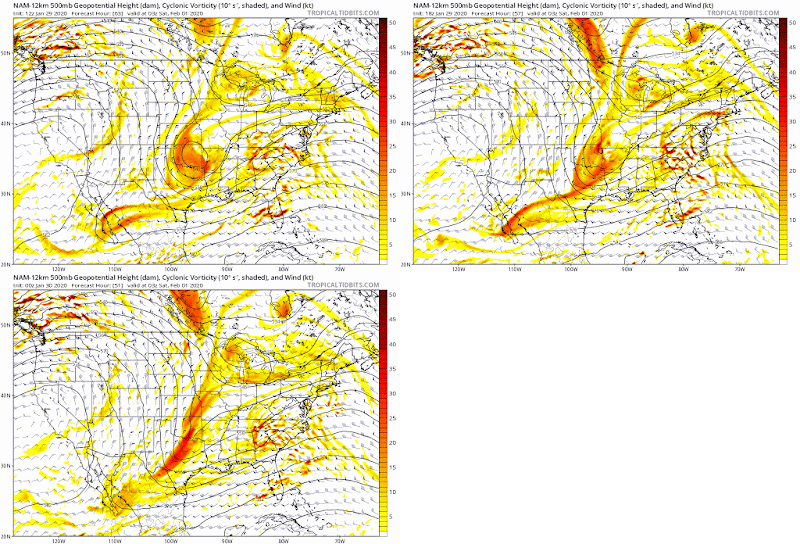
Looking at the NAM. 4 pieces at play at hr 69-72. A is the energy with the surface low. B energy is hitting the coast today, C is here already, D is hitting on Friday. As Philly pointed out, A right now seems to be on its own. Its not hooked up with anyone. It appears at this time it will remain that way. What I'm still focused on is how B doesn't pump the ridge in front, because C is there and D is reinforcing C. As many have pointed out, that northern Pac jet is too fast and doesn't allow B to round the trough in time for it to go negative. Instead D&C just pushes through as its own system and leaves B behind. This in turn pushes A out to sea. We need C&D to back off or B to speed up. With other storms, we've seen models slow down those northern features as time goes along, resulting in the westward adjustment.
This is B hitting the coast today - its really two parts. I didn't mark A, but its by El Paso. C is over the northern plains and Canada in front of B. C is kinda cut off and wanders to the lakes by hr 69.
Then you can see D hit on Friday. Its supposed to be north of the lakes 30 hours later. This may be our last hope of going westward. Especially if it slows or digs instead of flying to the lakes. That leaves C to wander around some more
But with that wind coming off the Pacific at 500mb, D is unlikely to do that

The above from from the 12z NAM.
The 18z showed some improvement, then 0z came back with a stronger C

Precip trended better at 18z too, then backed off as C pushed A out a little.

So a lot depends on B which is not on the coast yet, and not sampled. Meaning that there could still be a shift, either direction, Friday afternoon, a day before it hits.
1-28 - Still all over the map, but despite differences at 500mb
shown below, they are starting to focus on a storm brushing the coast. Energy from the gulf hit CONUS today.
Here are the differences at hr 96 from the 12z run.
And the individual runs...
EPS moved a little south as well.
 |
| 0z |
 |
| 12z |
1-27 Settling into two camps - coastal storm or out to sea.
In the out to sea camp is the might Euro. Its upper air pattern has been inconsistent
The 12z run has it out to sea
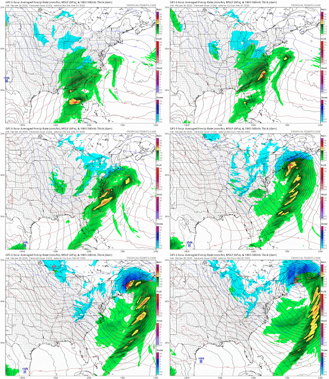
GFS is trending closer to the coast
12z
18z run
And now the Navgem, which is usually the furthest east, is a hit. Its usually understated with pressure and precip, but not this run. It's current position is a red flag for the Euro
1-26 - all kinds of madness. GFS miller A

Icon kinda miller A
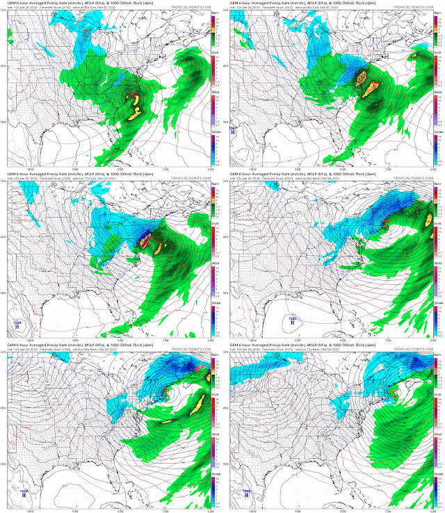
CMC crushes

Ukie offshore
EPS signs of Miller B
Meanwhile the Euro op just slides it out to sea
Right now the Euro Op seems to be the odd man out.
Problem is how many shortwaves there are. 5 on this map and they all interact. This is the GFS and the one over the NW dives down. On the Euro, it heads across Canada, which is odd.
Results in between this

or this


.gif)
