This winter is going to be governed by a strong El Nino. How strong is still up in the air as it got off
to a strong start, but may fade quickly. The CFS forecast shows this.
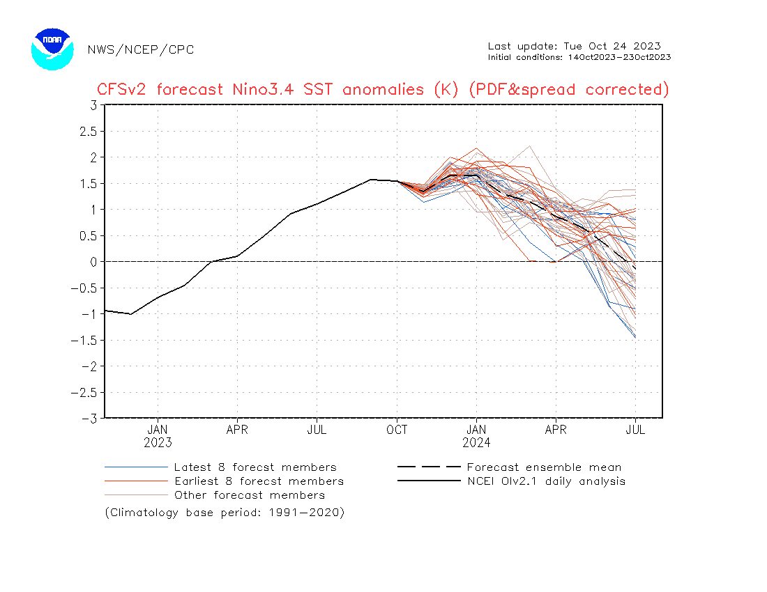
Other forecasts have a stronger El Nino, some as high as 2.5.
I like the 1.4-1.7 range. And that points to the winter of 2009-2010, which came out of double Ninas
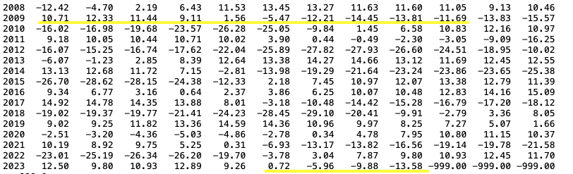
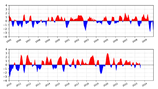
The above are the Nino's since 1990 and how they played out at BDR. I also did EWR and BDL.
Blue is colder/snowier than normal. ONI is a blend of DJF for those years, with emphasis on J.
Other comparisons to 2009.
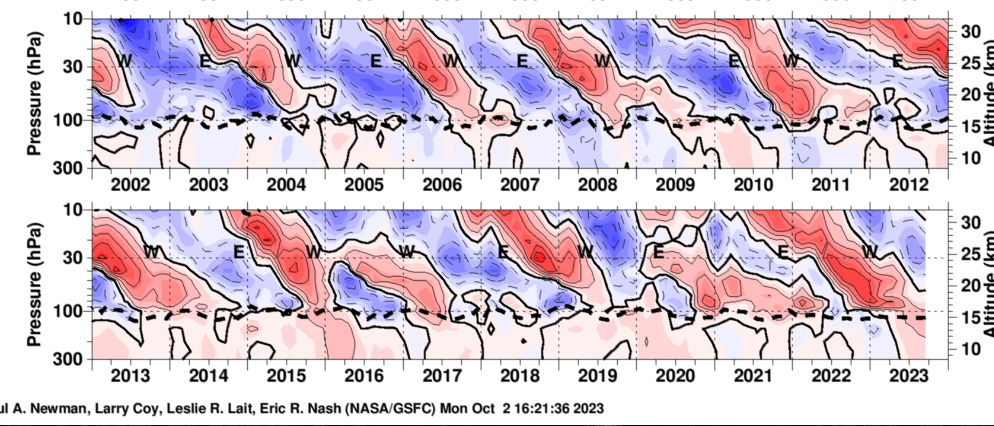
QBO lines up similar too.
2009 was closer to a solar min though.
Hurricane season isn't even close, only got to Ida in 2009.
Arctic Oscillation was negative. AO is interesting. It's much more muted this year, actually it's been muted since 2020,
but there is that dropoff about the same time in 09 and now.
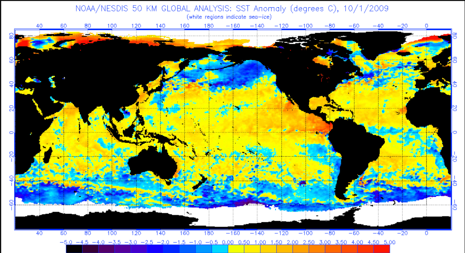
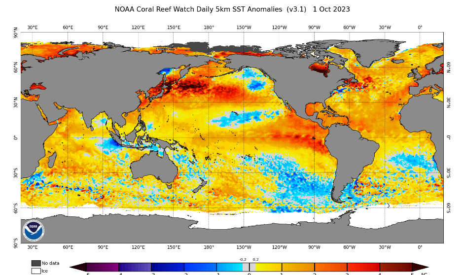
Sea Temps compared to 2009 are a little different in the details, mostly the Atlantic being different off the NE coast. But not too far off.
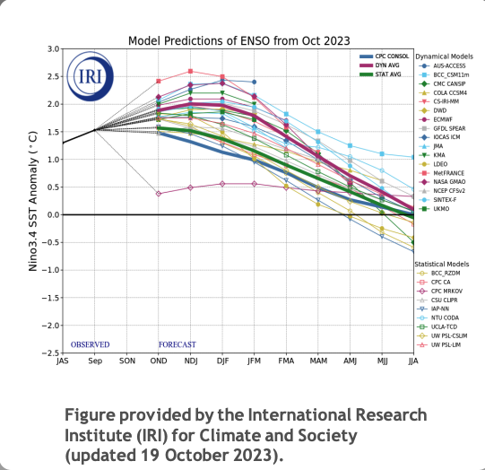
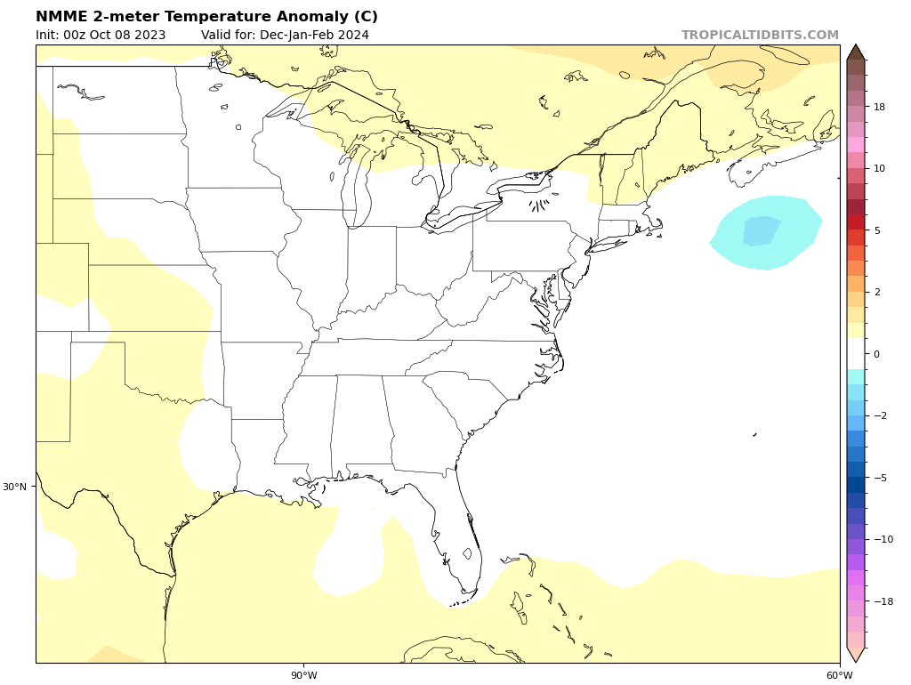
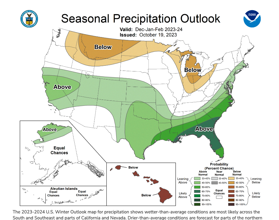
Lastly there are the seasonal forecasts by the models and mets.
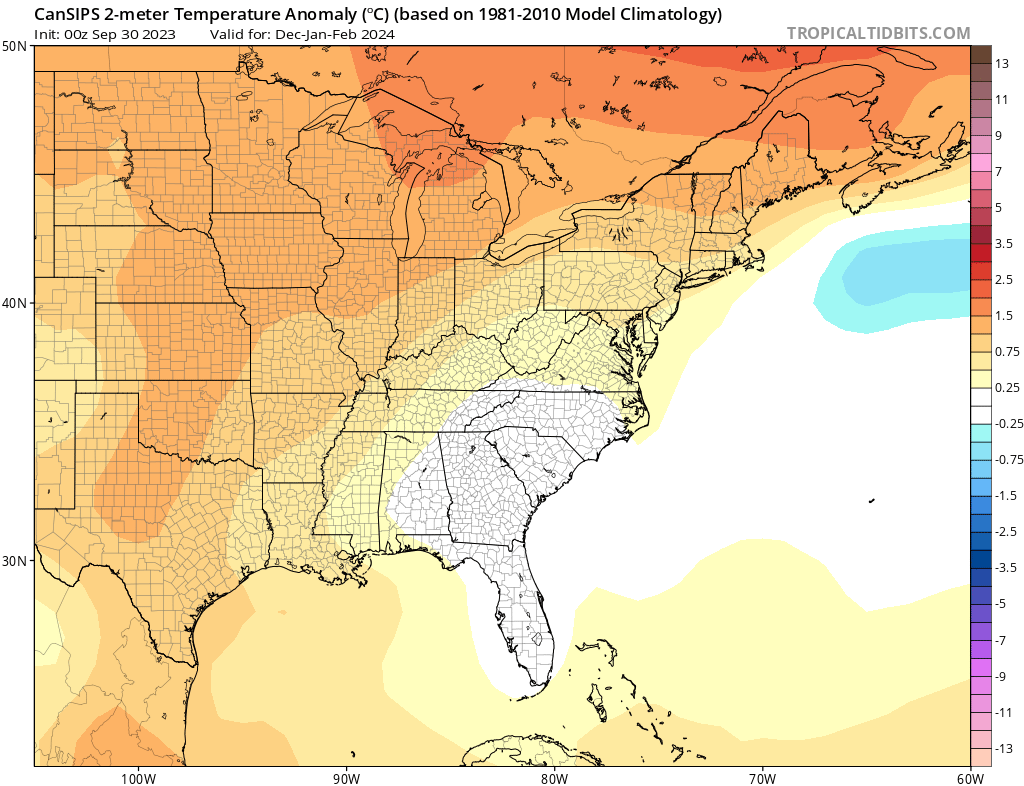
Models first. CFS and Cansips are warm for the season, but not overly warm. Cansips being a more traditional El Nino
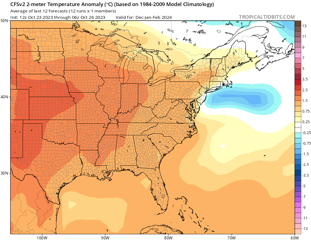
Euro and NMME are warm up front and cooler in Feb with NNME being really close to average.
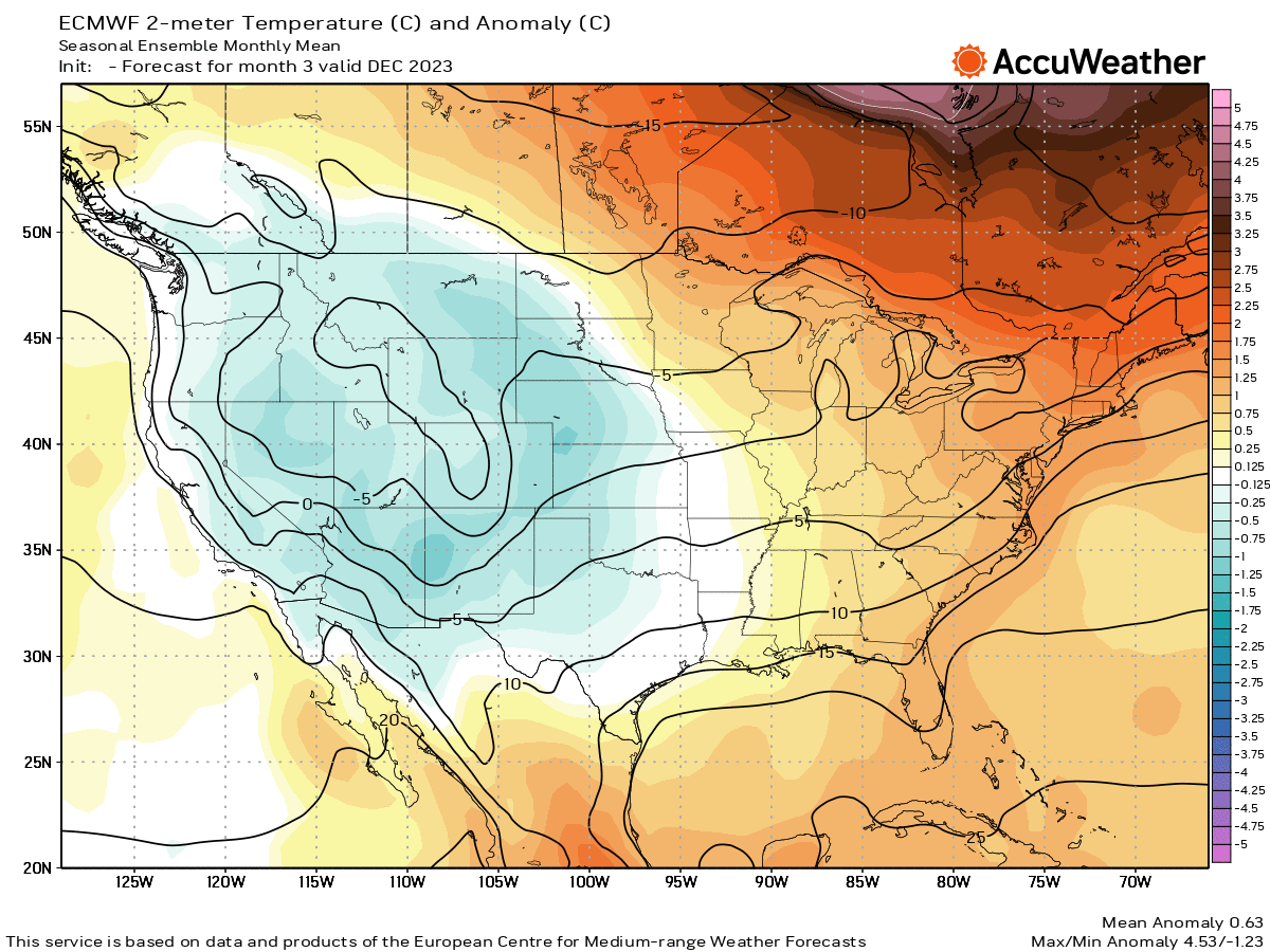
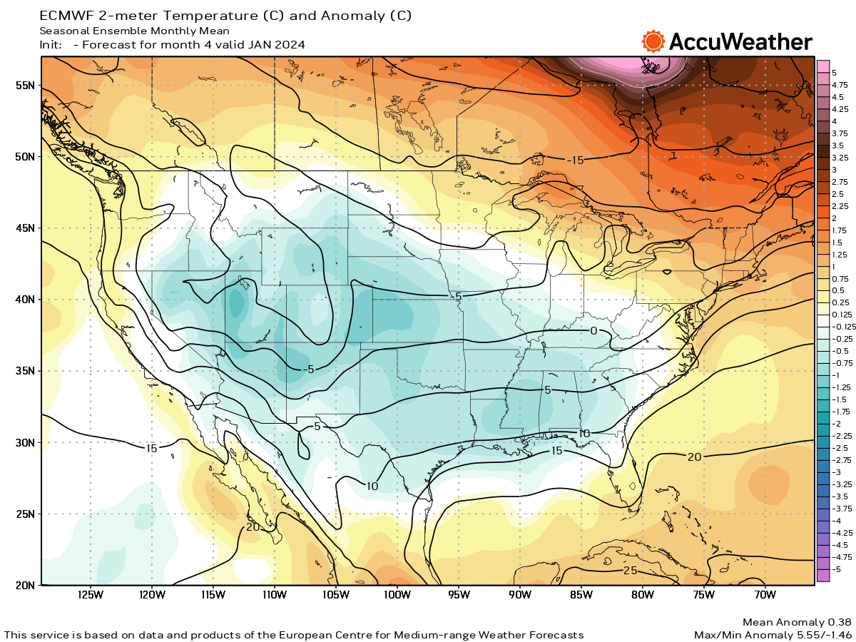
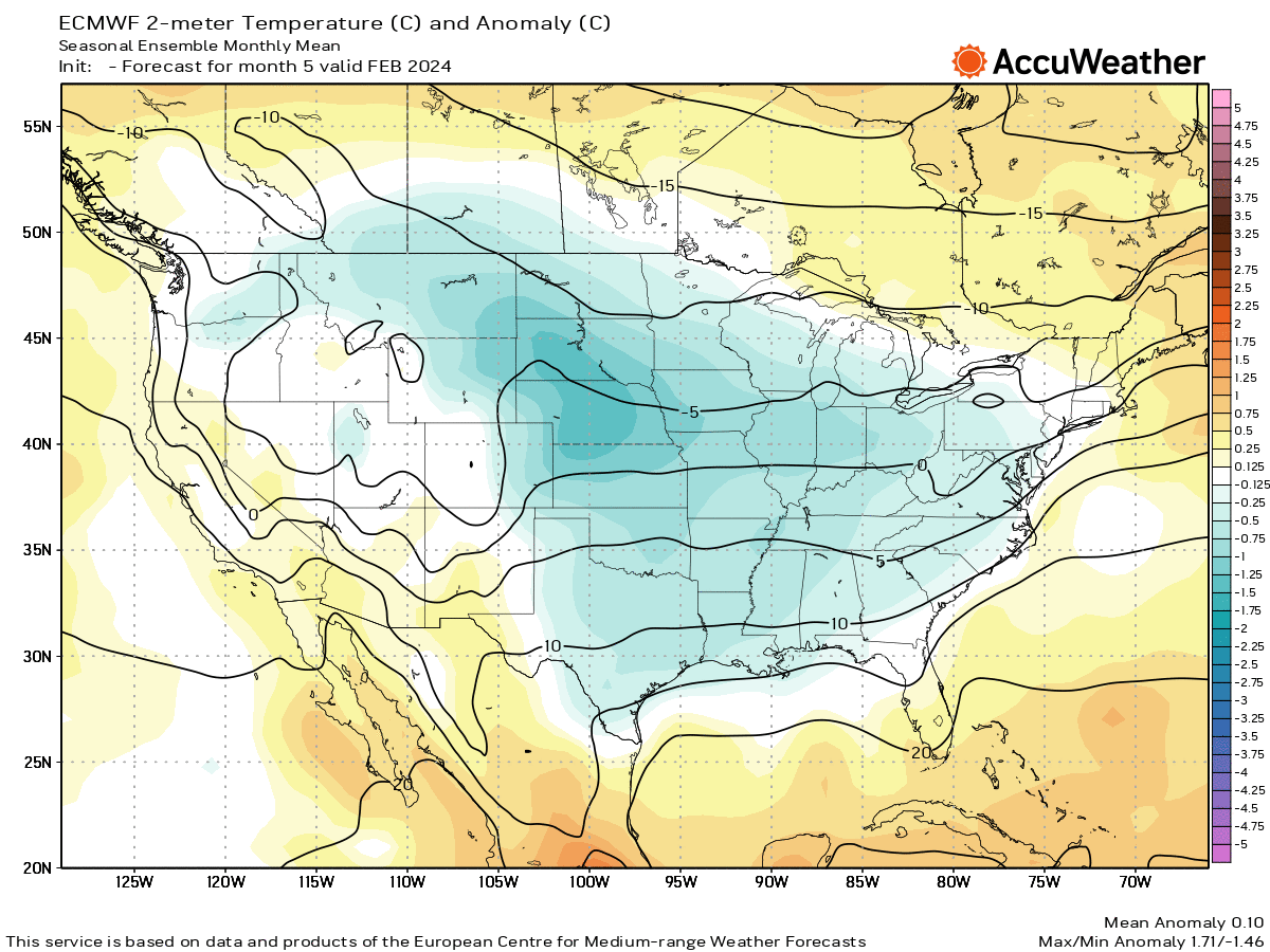
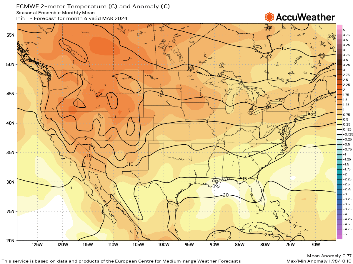
NOAA has a fairly typical El Nino as well.
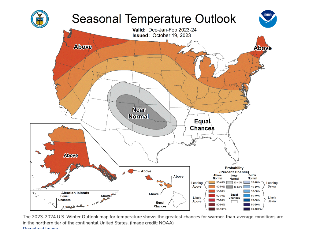
So I’m going to go with a cooler than normal winter for the Southeast. Warmer than normal for the Upper Midwest and near normal for the Ohio Valley back to Missouri.
For the Midatlantic and Northeast, the temp deviation will be a higher positive, say +2 to 2.5 in UNY/New England, with +1-2 in the PA/NJ/LI and closer to +.5-1 for DelMarVa and VA.
What does this mean for the Mid Atlantic and Northeast for snow? It’s a pretty safe bet that we get more snow than last year.
I still think the majority of the area gets less than average, but more like 10-25% less.
However, I do think there will be numerous big storms that will impact some in the NEMA more than others resulting in some higher than average totals.
Whether that’s coastal vs inland, I’m not sure. Whether its DC/PHL that sees 125% of their average or BOS, can’t tell. If you go back and look at the spreadsheet for 2009,
you’ll see that EWR and BDR (Newark and Bridgeport) had higher snow totals, BDL (Bradley Int’l) had less than average.
It’s just to hard to pinpoint, even when there’s a storm bearing down on us.
The first snowfall map was posted by me on Wxsphere.com earlier this week for Nov 1st, so remember to follow all the mayhem there.
Further to El Nino snowfall, two graphics from NOAA Climate.gov.


.gif)
