3/7 results
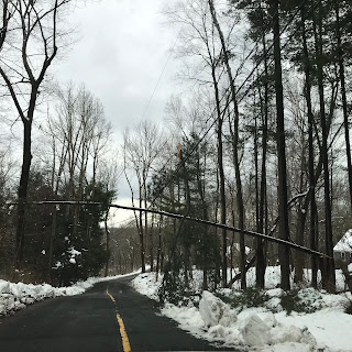
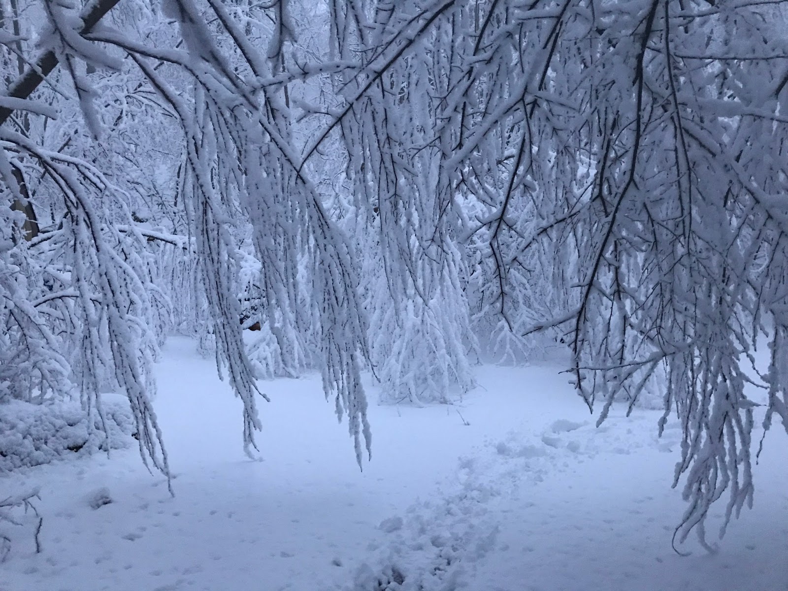
17" wiped on table, 13" on deck, 14" on grass. Lost power for 36 hours at 5pm. From 6 - 7 pm we had 4" of snow. Lots of thundersnow, mostly NYC south during the above radar loop
 |
| 5pm 3-7 |
 |
| 5pm |
 |
| 4" between 6 and 7pm |
 |
| 7pm |
 |
| 8pm |
 |
| 48 New Lebbon |
 |
| 22 new lebbon |
 |
| Grays Plain |
 |
| Still hill |
 |
| Still hill |
======================================================
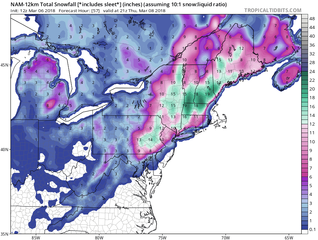
3-6 Will grab the 12z snow maps for later analysis. First wanted to post something that the NAM does at 850 with temps that I rarely see in our area.
Here are the snow maps
3-5 Evening
NAM Precip trend. 0z was a little weaker and the upper low came into play 3-6 hours later. Not much of an affect.
So it has this as the snow total.
Here's a 10:1 ratio picture with JFK getting 29"
Have a surface low going up west, spitting out a secondary and a cut off deepening upper low capturing the primary. The whole setup looks under done.
GFS upper low trend
NAM upper low trend
The above is the NAM run. Surprised the low doesn't deepen more
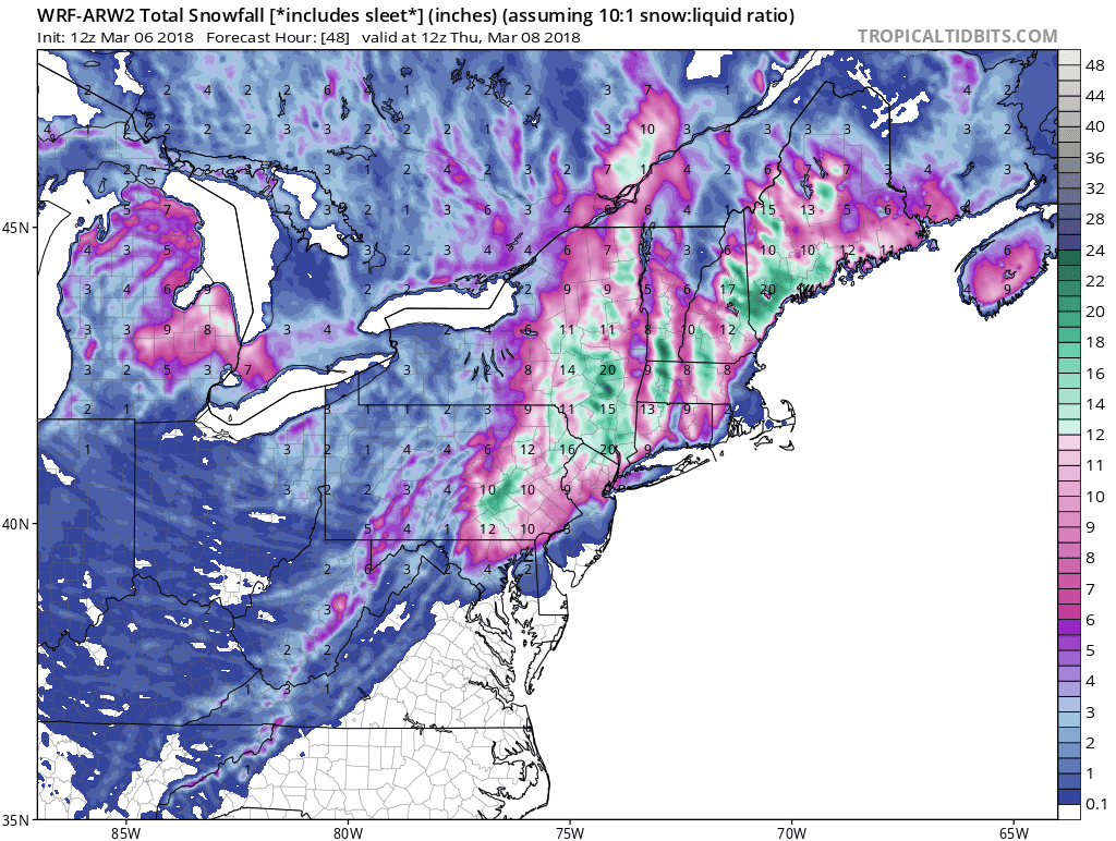
The Euro snow looks pretty good.
Or it could be the GFS
NAM looks a little far west with precip. My immediate area isn't less snow due to warmth, just less precip.


.gif)

No comments:
Post a Comment