11-24 evening. Earlier runs of the NAM showed a southern, supressed storm. 18 moved into our area with a snow event. CMC has moved to a right off the coast to BM snow event. GFS 12z looked like it was a low forming over NJ moving over the BM, still too close for snow in the city, but snow here. 18z run has it out to sea. Nogaps blows the storm up, inside the BM. 0z NAM has surpessed storm barely forming. UKMET has storm coming right over us and really deepening as it passes. JMA is way out to sea - it only sees the southern stream energy and no northern branch, whereas all the others are focused on the northern branch.
My thoughts are either 3-6 or nothing.
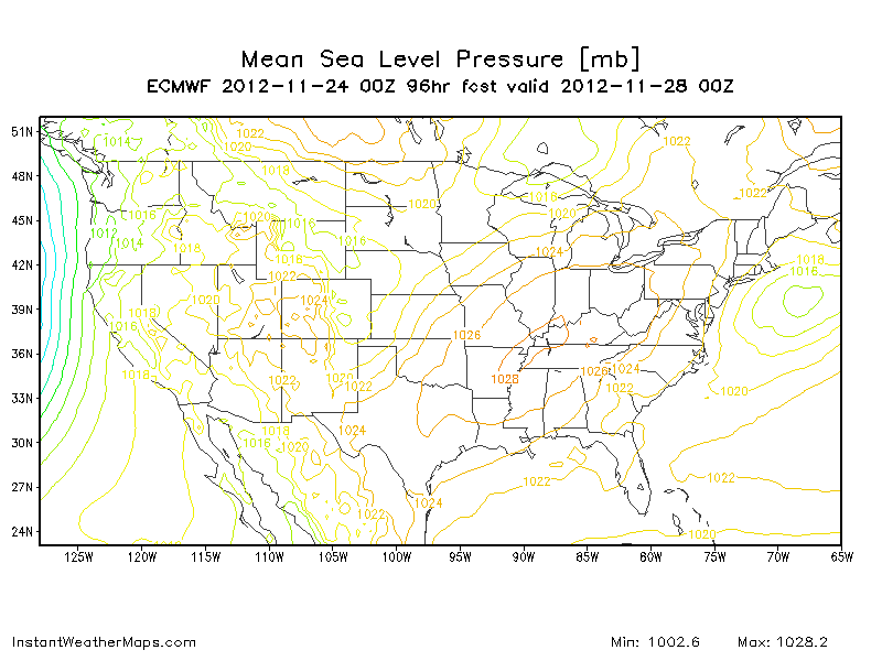
11-24 GFS caving to Euro, Euro comes in a bit further north. GFS now with low deep in the pocket with Euro outside the BM. GFS running 12-18hrs slower in timing as well. Both show some snow accumulation. CMC more towards Euro, if not slower and further east. UKMET supporting GFS. Still time for GFS to go further south and Euro further north.

11-22
Euro vs GFS


Thanksgiving morning - Euro has it out to sea, 0z GFS takes it from OK, up the Ohio river to Pit,over to ALB and up to Northern NH.
6z takes it from OK, up the ohio river, but only to the PA/MD border, then over NNJ and to CT/RI. 12z run should be interesting.
CMC forms in OK, moves to IL, then to Middle of PA, stalls/deepens, goes to albany to boston. Odd.
UKMET is from MO to Buffalo
Model spread is 500-600 miles at this point.
 11/21
11/21Have been watching this one for a while, but the runs were going either towards the G Lakes or up the Apps. Euro 12z flipped to a coastal today. This is probably unlikely as its the only run so far to do so and has no other support. Below is the picture. Weaker storm, but 850 temps favorable for snow. At this point Chances are less than 50% this happens.


.gif)

No comments:
Post a Comment