3-8 traveling, but checked 12z euro and gfs. Both pushed north. 0z euro and 6z gfs had a solid snowstorm with a little mix for areas nyc and north. 12z puts us all in rain. The shift nw with the gfs was expected, the euro not as much, though it's not much further north than other runs, just enough to mix. Cmc runs a west to east low right over NYC. 18z gfs comes in with major snowstorm as it runs the low south. So still no details. My best guess is HV north of ct, mass and northern New England are very likely getting a good snow. Ct, NYC, RI, SE Mass borderline. Does not look like areas south of central NJ will see much snow, if any. But the energy isn't sampled yet, so still time for changes.
3-7 evening. Euro a smidge further north, with12" line along I84. Euro ens control almost goes to NYC and is sub 980, bringing in a bunch of warmth. Euro Ens has a ton of spread in it. Favors shifting further NW.


3-7 Euro continues to send the northern stream further south and pick up the southern cutoff. Result is a 12"+ storm for much of the tristate north of I78. Storm goes from 996mb over OK, to 984 east of Atlantic City. Result is a larger area of warm advection snow infront, with dynamical snow as the low reaches the area. QPF over 1" for everyone. Precip type issues south of N Jersey.
GFS is all over the place yesterday -but the ensembles do have a a996 mb low over the benchmark, which is a good snowstorm. Today, the 0z run takes a low down to TX, swings it through the SE to the VA/NC border and heads NE. Not too different than the Euro, except weaker and further east, which is usual for this type of storm on the gfs (although nothing is usual this year). 6z goes OK, KY, VA where its a 1000mb low and slides east, well south of the BM, targeting PHL/SNJ with the most snow, again. Though most areas get >6". Not sure the 0z GFS has the qpf right as it taps the Gulf moisture. Result for 6z run is more inline with that runs track though.
CMC continues to bring the low out of Alberta and along the US border. Resulting in a nice blast of warmth on Tuesday and frontal passage with rain/snow showers.
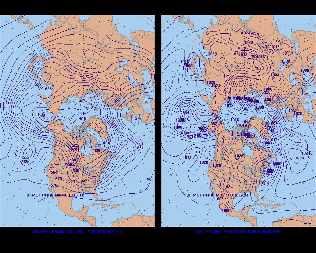
UKMET similar to CMC, though it somehow ends at 144 with a huge benchmark storm.
NAVGEM looks similar to Euro/0z gfs
DGEX looks like 6z gfs
3-6 - 0z gfs, 0z euro , navgem, jma have southern energy coming up coast. 6z gfs, cmc and ukmet have lp coming across the plains. All solutions provide precip, thought the cmc involves rain for our area and to the south. GFS and the Euro to a lesser degree are still active in the long range.
3-5 Some frames from the gfs and euro -still long range, but interesting. The stronger solutions give us 9-12 inches of snow. CMC is a bit different, still snows on the 13th. JMA similar to CMC. So its very difficult to ignore the 13th-14th time frame, even though the timing and type of storm vary.


.gif)

No comments:
Post a Comment