6-2 NHC initialized coverage of TD2 at 5pm on 5/27. The 5pm advisory on 5/28 upgraded to TS Bonnie. Weakened to a TD for the 8am advisory on 5/29 and made landfall on the Isle of Palms at 8:30am. http://www.nhc.noaa.gov/archive/2016/al02/al022016.update.05291241.shtml? NHC Advisories were discontinued on 5/30
Max winds seem to be 45mph. Rainfall was the biggest issue, as Bonnie continues to lurk along the coast even today. Moisture shunted off by a front brought heavy rains to NJ (2-4 inches reported), PA &MD (1-3 inches), but SC/GA/NC remained the jackpot with 8-10 inches. http://www.nhc.noaa.gov/text/refresh/MIAWPCAT2+shtml/020841.shtml
NHC has advised in its outlook that they will resume advisories today (6/2) as Bonnie is taking on tropical characteristics again.
5-23 update. ECMWF and EPS still have trouble brewing, except todays version has it moving NE rather than west. 0z GFS looks like it stirs it up on the 30th, sits it off FL/GA for a few days and heads NE, similar to Euro. 6z crashes it into GA. 12z into SC Both models are rather weak. CMC also has several LPs that are not cold core.
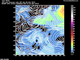
5-20 Interesting run on the GFS this morning. These are winds from a system forming in the Atlantic. June 1,2 and 4. Euro EPS has the feature much weaker and moving due west.
 |
| GFS 6-1 |
 |
| GFS 6-2 |
 |
| GFS 6-4 |
 |
| EPS 5-28 |


.gif)
No comments:
Post a Comment