Wednesday, January 27, 2016

One more storm? Mid Feb

2-2  Still differences in how the time period goes, but still active and with opportunities.  Here is the euro 12z snow map as an example.


Vs GFS

vs CMC

JMA is on board
CMC ensembles a little earlier


2-1  There's something happening here...what it is ain't exactly clear...

GFS has been pretty set on bringing one up the coast around the 9th, along with a clipper in the lakes. It keeps the two separated for our area
Euro operational is more bullish on a phased system, but to our west.  It pulls so much warmth ahead that there is no front end snow, which is unusual.
EPS is weaker on this system, like the GFS, but has a follow up on the 10th.


GFS ens looks more like just a clipper, as does CMC ens.
CMC operational looks like the GFS, with a two part system with the one from the south moving over us.  Should be a snow/rain setup. 


1-30  Time frame is still interesting.  There is also a chance of a coastal forming post frontal passage on the 6th.

1-27  With the storm going off to the east, all is pretty quiet.  Northern branch storms need to be watched for changes, but most are pulling to the lakes, which is what I expected to happen. Problem is no cold air so no front end snow/ice.   This changes around the 3rd or so as a potent storm moves through the lakes and brings down a new air mass significantly colder.  There may be one or two clippers within that airmass, but no major storm until the 10-12th time frame, as shown below.

While I wouldn't take this solution as gospel, I mean its 372 hrs out (62 more runs of the GFS!), but it does show the potential and the pattern. 

Sunday, January 24, 2016

1-29

1-27  So why do I still follow this one?  Check the gfs progression of precip through todays runs.
0z

6z

12z

18z
The 18z gfs has the low crossing 40N around 65W as a 984 low.  The 0z is at 62W as a 996 low.  That's a 160 mile shift west.


The NAM moved this way too, bringing this to the cape (which may have rain mixed in)
12 z Euro also moved west to dust the cape.
As did the UKMET

So the westward trend today, along with the strengthening, keeps me interested, even if its only flurries (from the northern system that is) that hit us.  I think it may back up a little more, so that Montauk and RI get in on a dusting.

++++++++++++++++++++++++++++++++++++++++++++++++++++++++++++++
1-26  Still out to sea, still watching, not likely going to snow.

1-25
Models are just offshore with this - close enough to still watch.  Afternoon update - most still out to sea. 
GFS
NAVGEM

Euro

CMC
UKMET

1-24
Watching for something to hit or pass us out to sea on Friday the 29th.  JMA had this yesterday, UKMET is close, Euro is in a great spot, down to 978, and the NAVGEM is also on board, just to the east, where it belongs.  GFS nowhere to be found as is the DGEX.  CMC is close enough to watch.

Euro

Navgem

CMC

Thursday, January 21, 2016

1-23 update

1-22 
Afternoon  NAM giveth, NAM taketh away.  This is why you discount the nam, especially on northern edges of the precip.  However, I do think its coming to its solution - GFS went from .26 at 6z to .45.  Euro is at .46.  Nam is at 1.5 -sounds too high still although the three images below show a sharp dropoff.  I still like 3-5, but we may get my original 6-8.  The NWS is at 3-5 for Fairfield county now, and their min is 0, max is 20.  So.....

0z >2 feet

6z top edge getting less
12 whole state getting less.

 
Morning  Still holding 3-5 for CT until either the NAM or GFS caves.  This is really a blend and if the GFS wins, we could be seeing 1", and if the NAM wins, 10"+

Low confidence forecast for CT, South of CT should get 6-12-18" North to south.
SREF ensembles, NAM and short range models continue to show copious amounts of moisture penetrating CT, with 1" qpf making it far north as Worcester.  GFS at 0z on the other hand is still bouncing around at DXR, with .09 at 12z, .3 at 18z (yesterday), down to .08 at 0z and back to .26.  Its having a problem both with the precip field, but also continues to reform a low 200 miles to the east (see below).  The cause of this is speculative - some have said convective feedback (model chasing tstorms to reform the low), others divergence, with my theories being another baroclinic boundary as the cold air comes around the low and into the gulf stream.  My theory is a bit off, as the gulf stream is further south, but the water temps are much higher.  Thus, cold air forcing warmer air up causing thunderstorms and a new low to form.  On the other hand, the GFS routinely sends precip/tstorms out of the low pressure resulting in convective feedback, which usually corrects by now.  So which is it - the low chasing the tstorms on the model, or thunderstorms forming due to a new low formed by the entrance of colder air over warmer water.

SREF plumes have been consistently increasing over the past 4 runs - 1.24, 1.25, 1.52 and 1.56.  NAM 12k is also consistently increasing from 1.2 12z yesterday to 2.19 6z today.   Euro has gone from .13 yesterday 12z, to .4 today 0z.  RGEM has also slowly crept north going from 1" at 0z to 3" at 6z.  If the global models (euro/cmc/ukmet/gfs) continue to increase the precip for DXR, we know the problem was convective feedback.  If they retreat, again, or if the NAM starts to drop drastically, then we know the NAM was in typical over blown precip mode.  The check for that is lp position, which is further north for the srefs, than the gefs, and the Nam holds the low under the UL while the GFS ejects the low east.  So I don't think the NAM is overdoing precip, considering how much is from the Gulf and an Atlantic which is 2-4 degrees above normal temps.  It may just be the NAM captures the low, the GFS doesn't.

1-21

After the gfs roller coaster yesterday, plus the increase in Euro, then decrease, the global operational models are indicating.... flurries.

GFS


Euro
But... the higher resolution short term models are still going to town. Two versions of the NAM exist  -both have the same QPF, but calculate snow differently.  Plus the SREF ensembles showing Oxford ct with over 1" of precip both on the 3z and 9z.  And the Euro control has 3-6 in most of CT.  CMC/GEM has 1-5.  Canadian Ensembles have .5" qpf for most of CT
accuweather version nam
instantweather version
GGEM
GEPS


So...  6-8 still looks unlikely, unless you weigh equally the sref with the gfs.  Typically the SREF is overstated, as is the NAM, when it comes to precip (QPF).  So I usually take 50-60% of that figure which still gives us 6".  This usually matches the GFS, but since it doesn't, blend in the GFS/Euro models and you get 3".  Have to lower to 3-5", but keep an eye on the still sharp cutoff.  One thing the NAM picture on instantweather is that the cutoff from 12" to 0"is about 30 miles wide, if not smaller.

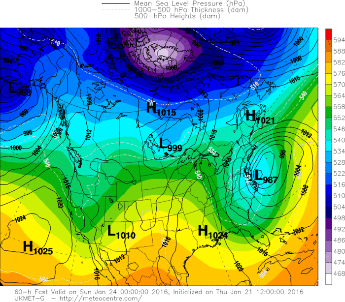
And then there is the incredability that this set up on the UKMET is not going to bring us more than flurries.

Tuesday, January 19, 2016

Weird Euro run

I found this afternoons Euro run disappointing and started to look into it more to see what went wrong. The premise of this storm is that the upper low catches the surface low and the storm explodes.  This has happened on past model runs, really at some time with all the different models for this storm.  What concerns me about the Euro is the reformation of the low where there is heavier precip (likely thunderstorms) is.  This can be 100s of miles further east as those storms shear out (which is also questionable).  To demonstrate - at hr 102 the 988 low is right on the coast.  Thunderstorms are out east and you can see the bend in the isobar indicating formation of a low.

Then at 114 the 988 low above becomes a 992 low and a 984 low develops out of that bend in the isobar.  

Once the storms peter out, then the low is back further west.

What makes this more confounding is that at hour 102, the slp is almost under the upper low (5350 line), with another low over by that convection.

 AT 108, you can see the new low jumped east, outside of the 5450 line

 Then still outside 5350 but just within 5400
 Then finally located where it should be. 


Lows normally don't jump around like that, and once stacked, they usually stay there until they occlude.  This happens all the way from the surface, to the 850 and 700mb layers.   Prevents the storm from venting properly and organizing properly.


Saturday, January 16, 2016

Note on teleconnections

Three major teleconnections to look at in the winter are the PNA, NAO and AO.  A positive PNA typically results in ridging in the west, trough in the east, thus cold here.  Negative NAO typically results in colder than normal and storminess, increased blocking as well.  Negative AO typically results in cold air leaving the poles and heading south, leading to cold.  Here are the teleconnections for today.  Black line is the observed value. 

 
As you can see, the AO is extremely neg, perhaps near record.  PNA is fairly positive and NAO fairly negative.  Yet today, we had a quick moving storm (not blocked) with rain and it reached 48 degrees at DXR, 13 degrees above normal.Heck even the EPO is barely negative, so you can't blame that either.  Just one of those winters.

Storm 3 - could be the one! (spoiler, it was)

 2/9  Set up is an upper low over TX that heads northeast into TN valley and then transfers off the coast. At the upper levels, there's ...