Wednesday, December 23, 2015

End of year first snowfall?

12-29  We had an inch of crust on the deck.  2.5" in the pint glass left outside.  There was some snow overnight which was observed by another local weather fan, and you could see it in the glass actually.


12-28  GFS never cools the 800mb layer under freezing, Euro moves warm air now to 6z.  Result, we should start as snow - if it comes down hard enough, there will be some evaporational cooling to cool that 800mb-700mb layer.  However, the ground also is not frozen, so a lot of melting is possible. After what should be a short burst of snow, if at all, more prolonged sleet.  By 7am just rain for most of CT, lower hudson valley, and other places that started as snow/sleet.   Maybe Hartford on north gets an inch, but tough to measure with the sleet there as well.  No other snow progged by the Euro EPS or GFS for the next 16 days, other than potentially some flurries.  

12-27  Euro still has this nose of warmth at 800-700mb level which may prevent much snow and result in more of an ice/sleet event.  Tues 0z is the last time that level is below 0c, and the precip falls from 6z-18z.  850's support frozen until 14z or so then warm to +9c. Euro has .32 as frozen, .39 as wet.  Surface temps mostly above freezing, so its sleet most likely to rain.

GFS is a bit trickier to forecast with .15 falling as frozen.  Then from 6z to 12z the 850 temps go from -4 to 2 with  .61 falling at during that time, then another .24 falling after.  750 temps look above 0 the entire time as well, with 800 temps only at -1 at 6z.  Again, signalling a more sleet time scenario.

Here are major model snow maps for the "event" from their 12z runs.
Euro 12z

GFS 12z

NAM 12z


12-24 - Brief update.  Euro and GFS still on board with 3-5 inches for most areas north of I80.  However, on the 12z Euro, there is a nose of warmth at the 700mb level which could cause more ice pellets than snow, as that warmth precedes the .53" qpf  progged to fall between 7 am an 1pm.   12z GFS did not have this feature. 

12//23  Evening update.  Euro showing front end snow 3-6 inches most of CT, Hudson Valley with 1-3 Northern NJ/NE PA and 6+ Mass on north.  Snow mostly accumulates 12z 12/29 to 18z with temps 29-32.  Temps are interesting -on the 27th, the high is 65-70 in parts of ct with 70-75 in parts of NJ.  Temps only get below freezing somewhere around 6z on the 29th and stay below until 21z or so.  Then by the 31st its back to near 50.
Euro 12z snow

Euro temps 12-28 0z


Noon
Hard to believe this but there is a chance of accumulating snow Mon-Wed as a system moves up to our west.  Its a warm front snow, so its snow to rain.  GFS is all over it.  Euro is much less, though still accumulating.  Here are two versions of the same GFS forecast - one software assumes all snow, the other factors in other frozen precip.  Plus the 6z gfs off Accupro and 0z Euro The latter makes sense as there will be cold air damming with warm air aloft, transitioning to snow, sleet, freezing rain then rain. Of course surface temps need to cooperate, which I'm a little skeptical of right now.  Plenty of time to change that attitude.

Insane map

Sane Map

Between the two - gfs 6z

Euro 0z


Tuesday, December 8, 2015

Christmas is coming

Note at top:   Normal high for Christmas at Danbury is 38, low 22.  For transparency, I'm rooting for the 70 degree sunny Christmas this year since we are hosting.

12-25  Warm sunny day until late in afternoon when it cooled into the 50's and the heater had to be lit.

12-24 Got to 67 here in the hollow.  Danbury recorded a 69, but could have gotten to 70 between hours.  Most areas to our S and W made it to the 70 degree mark as it cleared out faster.  It remained soggy and overcast most of the day here. Temperature deviation for the day, assuming we don't drop to under 56 by midnight, was +33.  

12-20  no new posts on Christmas as it remans as forecast on the 15th.  Some subtle differences between GFS and Euro when it comes to heights, but precip should clear out with only a chance of scattered showers in the afternoon.  Highs probably at midnight, in the 60s with daytime highs in the 50s.   GFS has 70s in S NJ for the 24th, 60s elsewhere with 50's for most of the area on the 25th. Euro is a bit warmer with some areas in CT in the 60s at 7pm on the 25th.

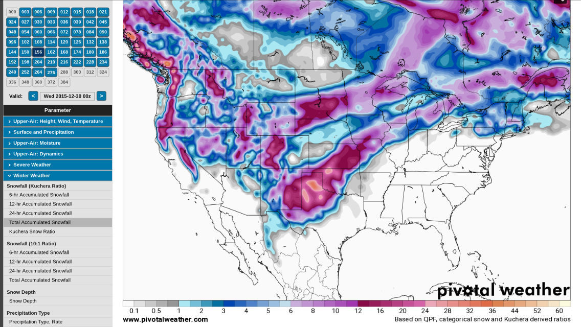
Just for kicks, here is the snow map for 7pm 12/25.  Yes, those are snow amounts in the 130 inch range out west.

Euro snow on ground  12-25


12-15 - Euro deterministic in range.  0z and 12z runs have rain moving through the 23rd into part of the 24th. Clear on the 25th.  Temps in the 60s on the 24th.  Likely the same on the 25th, but only out until 12z (7am) which has it in the 50s.

0Z gfs has rain moving through the 24th, clear on Christmas.  Cold front coming through with temps in the 60's to start, into the 50s in the afternoon.  Much like today actually. 12z similar, 70s in NJ at 7am.

12-14 12z eps still showing nasty wet storm.  Temps on the 24th nearing 70 and morning temps in the 60s for Christmas.   0z run brought the storm to our west with just a little rain.

0z gfs has the storm well to our west, with temps 65 to 70.   12z has cold front coming in from low to our NW in the afternoon.  12z temps 65-70.

At this point it looks rather warm and damp....

12-13 evening
EPS has nasty wet storm.  GFS is amazingly warm. High temps 12-24 and 12-25 in the 60's.


12-13  EPS (Euro ens control) has a warm front moving through, associated with a 984 low over Iowa.  Temps in the 50's with rain, mostly in the morn/early afternoon.  Temps on the 26th in the 60's and 70s in the tristate.
6z gfs is fair, mid 40s.  0z gfs has massive 972 low passing to our west on the 26th-27th with the 25th starting ok, but going downhill. Temps in the 40's on the 25th but into the 60's on the 26th.


12-12 - Eur ens control still showing fair and seasonable. No accumulating snow prior. 0z GFS  has a 996 low moving just to our NW with rain on 12-24, but fair and seasonable on Christmas. 12z GFS has frontal passage on the 23rd, chilly on the 24th, nice on the 25th -temps 45ish. 12z EPS control is 45ish as well, but with southwest winds and looks like drizzle. As of today, temps for the month of Dec are +7.2  Heating degree days are 271 of a normal of 1016 for season. Accuweather forecast for 12-25 is Cloudy, 51. 


12-11 Eur ens with a lakes cutter bringing in warm rain on Christmas/Christmas Eve.
12z gfs had front coming through 23rd, rain.  Then fair and mild on Christmas


12-10
Euro ens showing a liklihood of seasonal conditions, perhaps a little warmer than normal for Christmas Eve. Upper levels are mostly zonal with the only true storm entering CA.
0z GFS on the other hand has a strong storm just to our west, drowning us with a cold rain
  Note the gfs temps for Christmas eve in the 60's by Toms River
The 6z GFS run is full of activity - storm up the coast on the 19th, heavy rain for most, snow west of CPA and Upstate NY.  Another up the coast, combining with one over the lakes, which gives us heavy rain, with snow again in CPA and from the finger lakes west. Some snow perhaps on the back end as it bombs from 1000mb to 980mb.  Then Christmas night, a storm runs from the plains to DC which is blocked and heads to our west.  But, the cold front passes through and most of the NE will get some snow after it rains.  That run looks odd though.


12-8  Christmas time is now in the long range of the Euro control and the GFS.  Todays run of the euro control looks very warm on the 23rd.  Likely less than 5% of the country being covered by the 0 at 850mb line. 
0z Euro EPS

0z GFS 12-8

12z gfs 12-8
But a 978 LP moving to our west (see 850 low above) brings in some mood snow.


Tuesday, November 24, 2015

Waiting..


12/19  We did have some snow flurries today....

12/14 - Euro again getting close, gfs not there.


12/11 - 0z euro coming close on the 19th.

So is GFS... 6z at least


12/5  0z GFS has some more stronger storms for the 17th and 19th. But sadly rain at this point.  Euro Control completely different picture.  6z GFS has them going to our west and very warm. 
12-17 0z gfs
12/19 0z gfs


12/4 - its been since the below run on 11/26 that a snow storm has shown up.  This one one the 6z gfs.  Hr 348, so its just eye candy for now, and not even much at that since temps are marginal.  The GFS at least is putting a mean trough in the CONUS, but mainly to our west.  Euro control less interesting.  Still the next 10 days should be warmer than normal and dry.


Storms are showing up on model runs, but there is no consistency between models, nor from one model run to the next.  Dec 2 (Euro ens) and Dec 8(12z GFS) are todays examples of that.
12z GFS for 12/8
0z Euro ens control for 12-2

Friday, November 20, 2015

This winter looks like...


11/20   ...a little warmer in the beginning, less snow with colder more normal temps in Feb/Mar and more snow.  Not expecting many 6+ storms, but we could get half the seasonal snow with one hit in Feb/Mar. Overall I'm thinking +.2 to .5 for temps and within 5" of normal for snow.

Based on looking at various outlooks by various weather agencies and other forecasters, my prediction is for a winter which will not be nearly as cold as the last few, closer to normal temps and slightly less than normal snow with a few ice storms.  Aside from reading a dozen or so other forecasts, you can't ignore the El Nino, which is by many accounts the second strongest since 1950, and even stronger in some regions than 1997. 
Another look at 3.4
From LA Times, Region 3.4
1997/98 was a very warm and snowless winter (5" in Central Park).  There are mets out there who will point out this is not a 1997 El Nino (the strongest), but you can't discount it as a whole.  Approx 3/4 of the "mets" I follow are calling for a warm start, cold end.  The other 1/4 are calling for persistent warmth. Why I buy the majority argument is that El Nino is forecast to crash pretty hard in the spring.  As the Pacific shifts towards neutral, the jet should change and shift back to a more normal look.  The key is how fast El Nino tops off (is it now?) and how fast it declines.
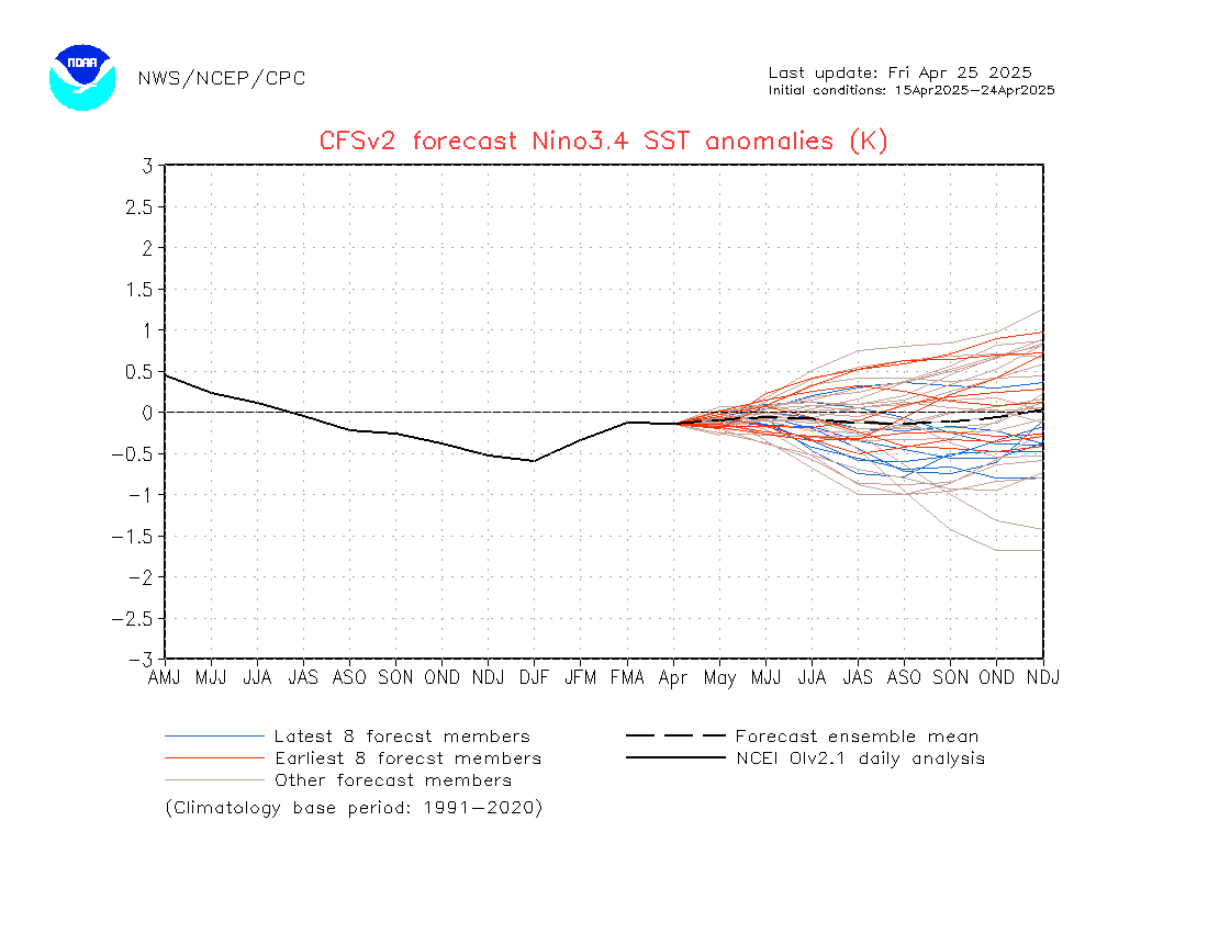
Predicted fall to neutral by summer


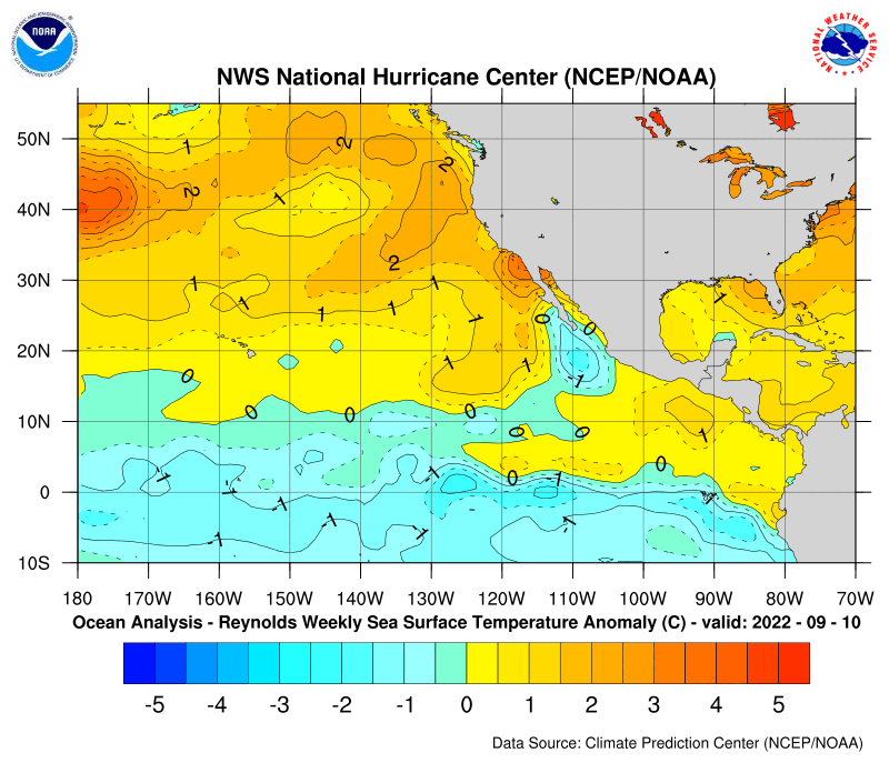
It could delay or peak a month late, which messes up just about everyones outlook. Both Atlantic and Pacific temps are warmer than normal, with the Atlantic looking like its transitioning out of a +AMO.  Warmer ocean temps lead to more moisture, so when winter pokes back at us, we are looking at a stronger subtropical jet and warmer Atlantic (for now) which would lead to stronger storms, heavier precip.  Hence the call for some potent storms later in the year.  The track of these storms would have to be worked out later though and its more likely than not they head to our west, resulting in either ice storms or front end snow, rain events.  Current storms are tracking to the lakes, which I expect to continue through December, but after that can't tell. 
http://www.nhc.noaa.gov/tafb/atl_anom.gif
Atlantic Temps = more moisture available
http://www.nhc.noaa.gov/tafb/pac_anom.gif
Pacific Temps = stronger storms in ST Jet
I'm also researching warm ocean temps and falling or rising heights and pressures as a result.  I would expect that as the difference in land v. sea temps expands, the affects of a warmer ocean increase.  If you're at the shore, particularly in the spring, you'll notice as the land warms, the rising air draws in the cooler ocean air creating a sea breeze.  The warmth draws in cold to replace it.  At night, the warmer ocean then draws in the air from the land, but its usually not as strong as the temp difference is less.  So does having near coastal water +2 to +3 warmer than normal cause air to be drawn to it from the cooler land.  Just a thought.

 Should throw in as a final point, that the latest (11/20) CFSv2 run for 850 temp anomalies as warmer in Jan, colder in Feb and Mar.  Not sure how I feel about that.
Feb 850 temp anomalies

March 850 temp anomalies


Tuesday, November 17, 2015

Opening day

11-22  Close, so close.  NMM had some snow forecast for Eastern CT.  But raw, cloudy and cold instead.  Nothing to blog about in the next ten days.


11/20 - close, but not seeing signs of it shifting back west. Less amped.  Wondering if this is a sign for the winter.

 Loading Maps...

11/17 First threat of a snow storm for the NE this season showing on the Euro this morning, but keeps the accumulating snow to our N and W.  While the 1000-500 thickness looks good (see blue line on MSLP chart), the surface and 925mb temps are too warm for our area.  850's support snow, so there may be some in the air, particularly in heavier bursts, but otherwise should be liquid and non accumulating.  GFS has some snow as well on the 6z run, but its weaker overall with the secondary development shown on the Euro. CMC has a dry front come through.

Tuesday, October 20, 2015

Halloween - always interesting.

10/27 - No major issues, but some wind and rain heading in Wed nite.
Here are the gusts from this mornings Euro.  Rain amts 1.-2". 2-2.5 on gfs.  GFS has gusts over 40mph for Interior sections, higher along the coast. Same with NAM. 


10/25  Euro and GFS show Pat redeveloping and hitting LA.  The GFS takes the moisture further east into our area for a soaking rain on Wed Nite.  Euro takes the bulk of the rain to our east.  The GFS shows a trough and snow in our area on the 30th (snow shower type, mood snow) while Euro doesn't.  Both have nice Halloween day.

10/23
 Euro shows frontal passage (fropa) on the 25th.  Then we need to watch what happens with the remnants of Patricia.  Some indication that some of the precip will make it up here on Thursday.  Euro has the remnants reform into a LP along the TX/LA coast and linger.  Then by Wed/Thurs get swept into a front. Interestingly, it also has a little noreaster developing as an upper low (UL) comes around.
Canadian looks similar to Euro, but brings LP further west. Spares us storminess, still good rain though.
0z Gfs doesn't develop the remnants as much, keeps the low onshore, and brings it up on Wednesday, again to our west, over Chicago.  It has a noreaster hitting us on the 3rd as a system again emerges from the gulf.


10/21

This mornings Euro was more benign - just a front coming through on the 29th and a brief cool shot.   Should be noted that TX area gets 6-12 inches of rain.
This afternoons Euro was more interesting - tropical storm hitting the TX/LA coast and moving north to the Lakes, with an upper low sliding in under it and the whole mess pushing through the NE on the 29th/30th.

The 0z GFS had the front come through dry on the 29th, but left the Gulf open for some development.  Tropical moisture streams northward on the 30-31-1 period, but nothing too organized.
12z run has nothing of note - normal frontal passages, nothing tropical.

0z CMC runs a deep low over the lakes, up to our west.  So does the 12z which results in chilly Halloween.

10/20  Since 2011, I've been keeping an eye on the last week or two of Oct for some interesting weather.  Low and behold, the models now go out to Halloween and there is some interesting features. 

Todays 0z GFS run has a hybrid tropical system heading up the coast and hitting us on the 30th.  Lot of rain, not too much wind.
The Euro has us setting up for a cold blast, deep trough.  It doesn't take much for that to close off  or go more negative and the storm/moisture offshore to come back in.  Need to watch this.
Case in point, the Euro ensemble control, which forms a noreaster, brings it back, but doesn't close off all the way and it gets pushed back out before hitting us.


FWIW - Canadian has a LP running from the Gulf up the OH valley, over us.  At the same time cold air presses down.  Should be serious snow in Northern NY,VT, NH with back end elsewhere. Bottom right box is the 0c line at 850mb (5,000 feet approx.)
So no consensus for now -but some interesting items to watch for the end of the month.

12z update Euro closes off low, but timing is a bit later and further west.  Still heavy rain, then upper low would go through with some snow.  GFS has a weaker miller A type storm forming over the SE and moving up the coast. 12z CMC has a storm moving up the Apps, with bombing out over us to 987mb and snow in the ADKs, Green and White mts.
Sunday, October 18, 2015

First snow

10-18  Had our first freeze overnight, first frost yesterday (10/17) morning and first snow around noon today.  Snow showers on and off so far from 12-2.  Looking forward to the mid week warmup.  Keep eye on gulf of mexico late in the week.


Feb 25 clipper

 Got a quick 3" in 3 hours this morning Driveway was completely clear